
- A-6382
- Item
- 1945
View from the south of Chemistry Building, Administration Building, Saskatchewan Hall, Qu'Appelle Hall and the Bowl.
457 resultados com objetos digitais Mostrar resultados com objetos digitais
View from the south of Chemistry Building, Administration Building, Saskatchewan Hall, Qu'Appelle Hall and the Bowl.
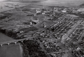
Looking northeast across the University Bridge towards the President's Residence, University Hospital, and Chemistry and Physics buildings. John Mitchell Building under construction; south area of College Drive and homes in foreground.
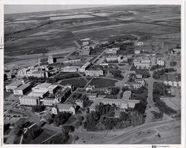
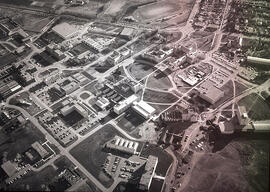
Looking east at Arts Building and the Bowl and surrounding buildings; the Canada Agriculture Research Station, Department of Public Works, at foreground left. Thorvaldson addition of Chemistry Building under construction, Marquis Hall, Physical Education Building addition and Qu'Appelle Hall addition visible.
Aerial view facing southwest with the barns and feed (grain) elevator in foreground; the Bowl and surrounding buildings at centre and University Hospital in background. View also shows construction of Thorvaldson Wing of Chemistry Building; Marquis Hall, Physical Education Addition and Qu'Appelle Hall Addition.
View facing north with Saskatchewan Hall, Qu'Appelle Hall and the Bowl and surrounding buildings in foreground. View shows the Thorvaldson addition of the Chemistry Building under construction, and the Prairie Migratory Bird Research Building.
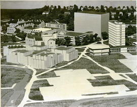
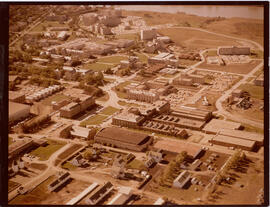
Three-dimensional models of a portion of the campus, including the Arts Building and the Murray Memorial (Main) Library.
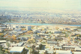
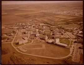
Campus in foreground, the South Saskatchewan River and Saskatoon in background.
Parte de Town Collection
Looking over Indian Head, you can see the Gordon Hotel as well the Methodist Church and, in the distance, the original Presbyterian Church.
Aerial photo of Indian Head Collegiate and former airport
Parte de Town Collection
Photograph taken from an airplane looking northeast over the Indian Head Collegiate (high school) to the former airport - now Indian Head Golf Course.
Aerial photo of Indian Head from the north
Parte de Town Collection
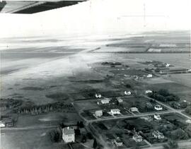
Photograph taken from an airplane looking south toward Indian Head. The Experimental Farm barn and office building are on the far left of the photograph.
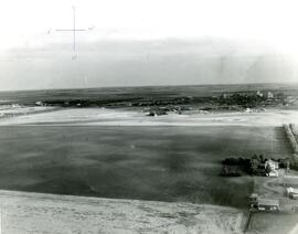
Aerial photo of Indian Head from the southeast
Parte de Town Collection
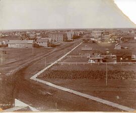
Photograph taken from an airplane looking northwest with the railway in the foreground and looking directly up Grand Avenue
Parte de Institute for Northern Studies fonds
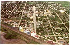
A closeup of a street in Prince Rupert, BC.
Winter view looking north across campus.
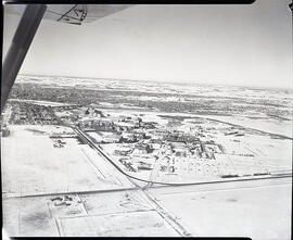
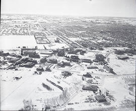
Winter view looking south across campus.
View facing south with Arts and Chemistry buildings and the Bowl in foreground. Also visible is construction of Marquis Hall and the St. Thomas More College addition.