Aerial view of Moose Jaw, Saskatchewan
- 68-006
- Item
- [before 1960]
Part of MJ General Photograph Collection
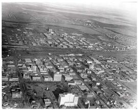
Aerial view of central Moose Jaw looking north
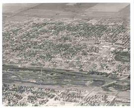
Aerial view of Moose Jaw, Saskatchewan
Part of MJ General Photograph Collection
Aerial view of central Moose Jaw looking north
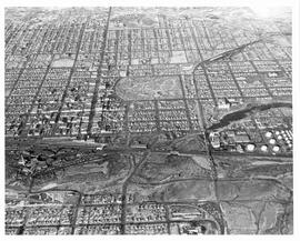
Aerial view of Moose Jaw, Saskatchewan
Part of MJ General Photograph Collection
Aerial view looking northwest over Canadian Pacific Railway yards with the CPR Roundhouse visible

Aerial view of Moose Jaw, Saskatchewan
Part of MJ General Photograph Collection
Aerial view of Moose Jaw, Saskatchewan, south of downtown area; Crescent Park is also visible
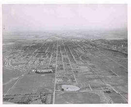
Aerial view of Moose Jaw, Saskatchewan
Part of MJ General Photograph Collection
Aerial view of Moose Jaw, Saskatchewan from the Rosedale Cemetery looking east; the Drive-in and Caribou Heights Athletic Field are visible as well.
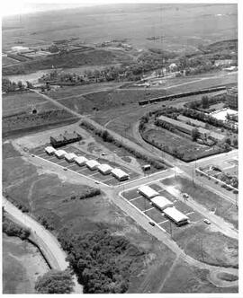
Aerial view of Moose Jaw, Saskatchewan
Part of MJ General Photograph Collection
Aerial view of new houses in the River Park area of southeast Moose Jaw, Saskatchewan

Aerial view of Moose Jaw, Saskatchewan
Part of MJ General Photograph Collection
Aerial view southward down Main Street towards Canadian Pacific Railway station; Civic Centre seen in foreground
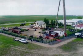
Aerial view of Museum and grounds
Aerial view shows the Tea House, Fire Hall, School, Church, Blacksmith Shop, tractors, and main buildings. Photographed from a SaskTel balloon in 2008.
Aerial view of northwest quadrant of Lloydminster
Part of LRA Photograph Collection
View of Northwest portion of Lloydminster with the old Catholic Church in foreground
Part of City of Regina fonds
Aerial view of downtown Regina (looking north); Hotel Saskatchewan (Victoria Avenue) to northern City Limits; Metropolitan United Church (Lorne Street) to Broad Street.
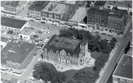
Aerial view of Regina City Hall and Downtown
Part of City of Regina fonds
Aerial view of downtown Regina with Regina City Hall [nicknamed the "Gingerbread Hall"]in centre foreground.
Aerial view of Regina looking northeast
Part of City of Regina fonds
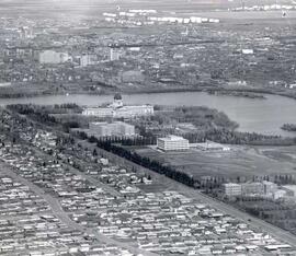
Aerial view looking northeast over the city. The Legislative Buildings, Wascana Lake and Campion College are seen in foreground. From Thornton Avenue to outer city limits (north), Rae Street to east edge of Wascana Park.
Aerial view of Regina, Saskatchewan
Part of City of Regina fonds
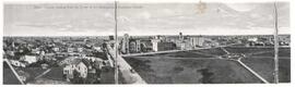
The City of Regina as seen from the top of the Metropolitan Methodist Church. Victoria Park is visible in the left of the frame. Little landscaping has been done to the park.

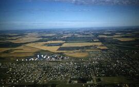
An aerial view of Rosetown looking north. Appears to be late fall.
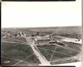
Aerial view of Swift Canadian Co. Ltd. plant, Moose Jaw
Part of MJ General Photograph Collection
Aerial view of Swift Canadian Co. Ltd. plant, sign reads "Manufacturer of Premium hams and bacon, Silverleaf brand pure lard"
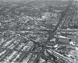
Aerial view of the CP rail-yards and warehouse districts
Part of City of Regina fonds
Rail-yards and warehouse district from the air. From Broad Street to Broder Street, Arcola Avenue to outer city limits (north).