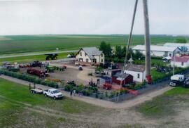
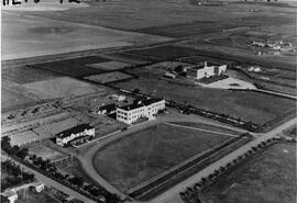
Aerial view of Museum and grounds
- MUSE2.002
- Item
- 2008
Aerial view shows the Tea House, Fire Hall, School, Church, Blacksmith Shop, tractors, and main buildings. Photographed from a SaskTel balloon in 2008.
374 results with digital objects Show results with digital objects
Aerial view of Museum and grounds
Aerial view shows the Tea House, Fire Hall, School, Church, Blacksmith Shop, tractors, and main buildings. Photographed from a SaskTel balloon in 2008.
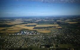
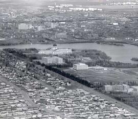
Aerial view of northwest quadrant of Lloydminster
Part of LRA Photograph Collection
View of Northwest portion of Lloydminster with the old Catholic Church in foreground
Part of City of Regina fonds
Aerial view of downtown Regina (looking north); Hotel Saskatchewan (Victoria Avenue) to northern City Limits; Metropolitan United Church (Lorne Street) to Broad Street.
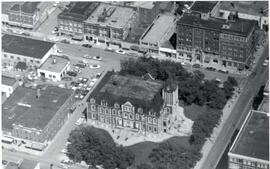
Aerial view of Regina City Hall and Downtown
Part of City of Regina fonds
Aerial view of downtown Regina with Regina City Hall [nicknamed the "Gingerbread Hall"]in centre foreground.
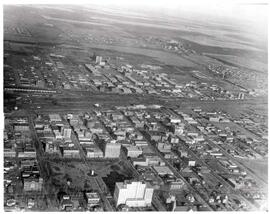
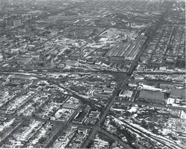
Aerial view of Regina looking northeast
Part of City of Regina fonds
Aerial view looking northeast over the city. The Legislative Buildings, Wascana Lake and Campion College are seen in foreground. From Thornton Avenue to outer city limits (north), Rae Street to east edge of Wascana Park.
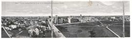
Aerial view of Regina, Saskatchewan
Part of City of Regina fonds
The City of Regina as seen from the top of the Metropolitan Methodist Church. Victoria Park is visible in the left of the frame. Little landscaping has been done to the park.
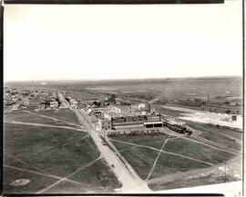
Aerial view of Swift Canadian Co. Ltd. plant, Moose Jaw
Part of MJ General Photograph Collection
Aerial view of Swift Canadian Co. Ltd. plant, sign reads "Manufacturer of Premium hams and bacon, Silverleaf brand pure lard"
Aerial view of the CP rail-yards and warehouse districts
Part of City of Regina fonds
Rail-yards and warehouse district from the air. From Broad Street to Broder Street, Arcola Avenue to outer city limits (north).
Aerial view of the hospital and nurses residence
An aerial view of the Rosetown Hospital and adjacent nurses residence with St. Joseph's convent beside them.

Aerial View of the Melfort Research Farm
Part of Melfort General Photo collection
An aerial view of the Melfort Research Farm in the winter time.
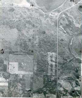
Aerial View of The Rural Municipality of Biggar #347
Part of Biggar Photograph Collection
An aerial view of TP 35 RG 15 in the Rural Municipality of Biggar # 347
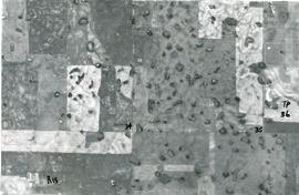
Aerial View of The Rural Municipality of Biggar #347
Part of Biggar Photograph Collection
An aerial view of TP 36 RG 15 in the Rural Municipality of Biggar # 347
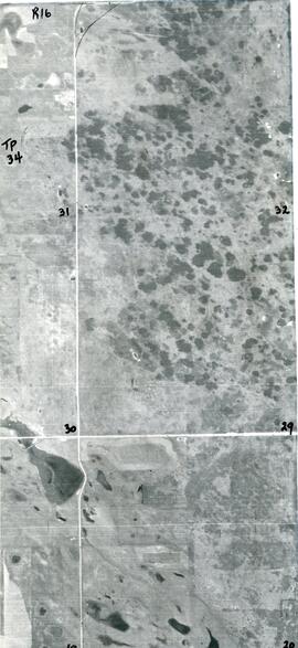
Aerial View of The Rural Municipality of Biggar #347
Part of Biggar Photograph Collection
An aerial view of TP 34 RG 16 in the Rural Municipality of Biggar # 347
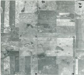
Aerial View of The Rural Municipality of Biggar #347
Part of Biggar Photograph Collection
An aerial view of TP 35 RG 16 in the Rural Municipality of Biggar # 347
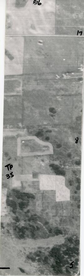
Aerial View of The Rural Municipality of Biggar #347
Part of Biggar Photograph Collection
An aerial view of TP 35 RG 16 in the Rural Municipality of Biggar # 347