- ZE2.006
- Item
- [1993]
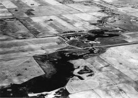
An aerial view of the Blind Creek near Zealandia flooding in the spring. The water flowed west to east and met up with the South Saskatchewan River near Saskatoon.
8 results with digital objects Show results with digital objects
An aerial view of the Blind Creek near Zealandia flooding in the spring. The water flowed west to east and met up with the South Saskatchewan River near Saskatoon.
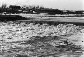
Blind Creek flooding over Trapp's No. 1 dam spillway. Water flows from west to east to join the South Saskatchewan River near Saskatoon.
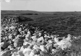
Trapp's Dam - second dam reservoir full in 1994 after being washed out in 1992 then repaired.
HW #4 with Eagle Creek flood waters cresting over the bridge. A highway crew are working on the flooded bridge on the highway.
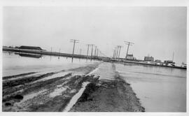
Water pools across the east road leading into Sovereign.
Rosetown General Photograph Collection
The Rosetown General Photograph Collection spans approximately ten decades of the history of Rosetown and district, consisting of photographs taken by and collected by the Rosetown Centennial Library Archives.
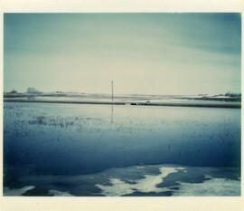
View from north of Rosetown looking south. Fields are flooded. Elevators and a farm service centre can be seen in the distance.
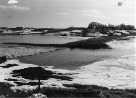
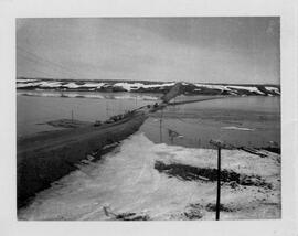
Heavy spring run-off goes over the road at the Trapp family water conservation dam.
Unique and interesting photos from the Rosetown area.
Photos of Zealandia people and places post-1918.
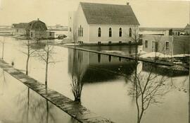
Zealandia during a spring flood. The United Church is front and centre. The water is nearly running over the wooden sidewalks in places.