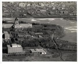
Saskatchewan Legislative Building and Grounds
- 1.0001.04
- Item
- June, 1959
Aerial view of the Saskatchewan Legislative Building and surrounding grounds including part of Wascana Lake in Regina, Saskatchewan
Saskatchewan Photo Services
457 results with digital objects Show results with digital objects
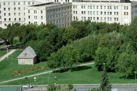
Saskatchewan Legislative Building and Grounds
Aerial view of the Saskatchewan Legislative Building and surrounding grounds including part of Wascana Lake in Regina, Saskatchewan
Saskatchewan Photo Services
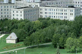
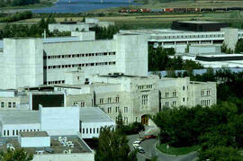
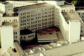
Royal University Hospital and Little Stone Schoolhouse
Part of Educational Media Access and Production (EMAP) fonds
Aerial views of campus
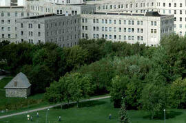
Royal University Hospital and Little Stone Schoolhouse
Part of Educational Media Access and Production (EMAP) fonds
Aerial views of campus
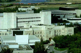
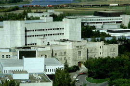
Part of Educational Media Access and Production (EMAP) fonds
Aerial views of campus
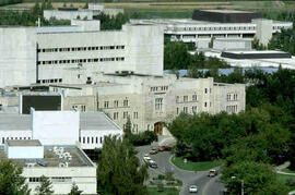
Part of Educational Media Access and Production (EMAP) fonds
Aerial views of campus
Part of Educational Media Access and Production (EMAP) fonds
Aerial views of campus
Part of Educational Media Access and Production (EMAP) fonds
Aerial views of campus
Part of Educational Media Access and Production (EMAP) fonds
Aerial views of campus
Part of Educational Media Access and Production (EMAP) fonds
Aerial views of campus

Shows the layout of Rosetown from Highway 4 N to 6th Ave. and Main Street to 9th Ave.

Looking northeast. Main Street, Highway 4, and 6th Avenue are marked.

A view of old Rosetown facing northwest. Elevators and train station on the left.

Rosetown from the air looking southwest. Centre: Anglican Church. Across Main St.: Dr. Perrim's House. South: Presbyterian Church, Rosetown Hotel.

Rosetown in 1953 or 1954 looking southeast. Underside of plane wing in upper corner of photo.

Looking northeast from south of town. Herschel Arthur farm at right in centre. CNR rail line marked.