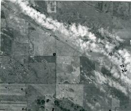
Aerial View of The Rural Municipality of Biggar #347
- 09.710.38E
- Pièce
- ca. 1960
Fait partie de Biggar Photograph Collection
An aerial view of TP 36 RG 15 in the Rural Municipality of Biggar # 347
375 résultats avec objets numériques Afficher les résultats avec des objets numériques
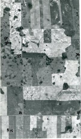
Aerial View of The Rural Municipality of Biggar #347
Fait partie de Biggar Photograph Collection
An aerial view of TP 36 RG 15 in the Rural Municipality of Biggar # 347
Aerial View of The Rural Municipality of Biggar #347
Fait partie de Biggar Photograph Collection
An aerial view of TP 36 RG 15 in the Rural Municipality of Biggar # 347
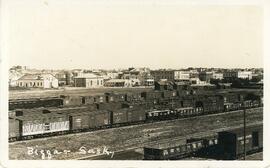
Fait partie de Biggar Photograph Collection
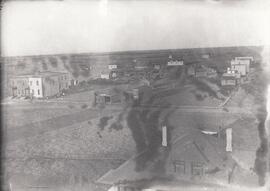
An aerial view of the Canadian National rail yard with the town of Biggar, Saskatchewan in the background
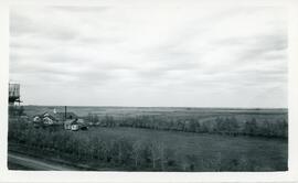
The Dairy Pool, Water Tower and Tourist Camp
Fait partie de Biggar Photograph Collection
An aerial view of the tourist camp, The Dairy Pool, and the water tower in Biggar, Saskatchewan
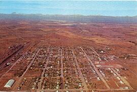
An aerial view of Biggar, Saskatchewan
Fait partie de Biggar Photograph Collection
Aerial view of the town of Biggar, Saskatchewan and the farmland beyond it
Sans titre
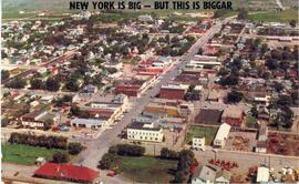
Postcard: "New York Is Big - But This Is Biggar"
Fait partie de Biggar Photograph Collection
Colour postcard showing an aerial view of the town of Biggar, Saskatchewan.
Sans titre
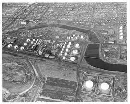
Aerial view of British American Oil Refinery in Moose Jaw, Saskatchewan
Fait partie de MJ General Photograph Collection
Aerial view of the British American Oil Co. Refinery and surrounding area near the Moose Jaw River in Moose Jaw, Saskatchewan. Union Hospital and St. Margaret's Catholic School are visible in photograph as well.

Aerial view of British American Oil Refinery in Moose Jaw, Saskatchewan
Fait partie de MJ General Photograph Collection
Aerial view of the British American Oil Co. Refinery and surrounding area near Moose Jaw River in Moose Jaw, Saskatchewan.
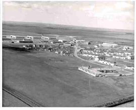
Canadian Forces Base, Moose Jaw, Saskatchewan
Fait partie de MJ General Photograph Collection
Aerial view of the buildings and roads at Canadian Forces Base, Moose Jaw, Saskatchewan
Fait partie de MJ General Photograph Collection
Aerial view of Tuxford, Saskatchewan ‘in the early years’.
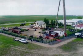
Aerial view of Museum and grounds
Fait partie de Rosetown General Photograph Collection
Aerial view shows the Tea House, Fire Hall, School, Church, Blacksmith Shop, tractors, and main buildings. Photographed from a SaskTel balloon in 2008.
Fait partie de Rosetown General Photograph Collection
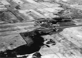
An aerial view of the Blind Creek near Zealandia flooding in the spring. The water flowed west to east and met up with the South Saskatchewan River near Saskatoon.
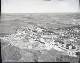
Fait partie de University of Saskatchewan Photograph Collection
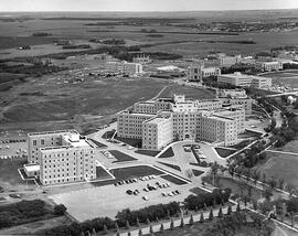
View looking northeast of campus. Road to President's Residence running along bottom of image; University Hospital at centre. Saskatchewan Research Council building under construction in background centre; University lands and Sutherland also in background.
Fait partie de University of Saskatchewan Photograph Collection
View looking southeast across campus, with the Bowl at centre.
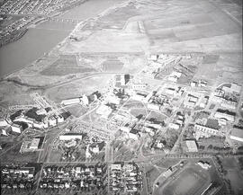
Fait partie de University of Saskatchewan Photograph Collection
View looking northwest across campus, with the Bowl at centre. Varsity view homes, Griffiths Stadium and College Drive running along bottom of image.