- A-5310
- Item
- July 1970
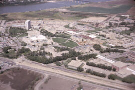
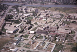
Looking northwest at Physical Education Building and the Bowl with surrounding buildings in foreground. Portion of College Drive visible at bottom.
120 results with digital objects Show results with digital objects
Looking northwest at Physical Education Building and the Bowl with surrounding buildings in foreground. Portion of College Drive visible at bottom.
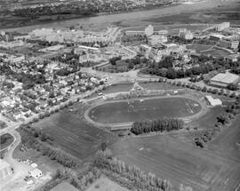
Looking northwest at a track meet underway at Griffiths Stadium; fields in foreground. The Bowl with surrounding buildings and University Hospital in background.
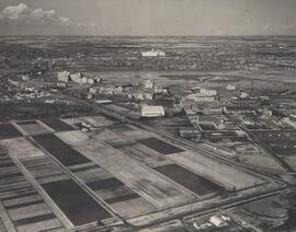
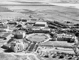
Looking west with barns and feed (grain) elevator in foreground, the Bowl and surrounding buildings, and University Hospital at centre. College Drive visible on left side of image.
View with the Bowl at centre with surrounding campus buildings; College Drive running along bottom of image.
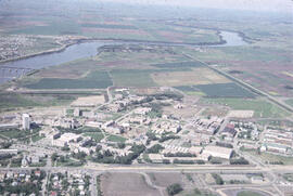
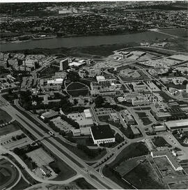
View facing north with College Drive and campus in foreground.
Looking north at intersection of Elliott and Bottomley streets in foreground. Batoche Trail visible at front of Chemistry Building at middle of image; Power House is second building from right at top.
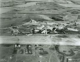
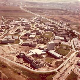
Looking northwest at construction work on St. Thomas More College and the north wing of Murray Memorial (Main) Library. College Drive runs along centre of image with campus buildings and Saskatoon city in background.
View facing west with University barns and fields in foreground, the Bowl and surrounding buildings at centre
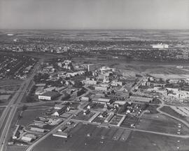
Looking east at campus buildings and the Bowl at centre.
Looking southeast with Commerce, Law and Arts buildings in foreground; the Bowl and surrounding buildings in centre. Prairie fields and residential districts in background.

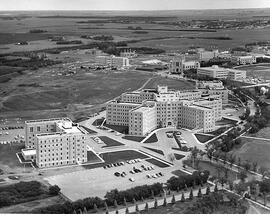
View facing southwest with Murray Memorial (Main) Library and Arts Building in foreground, Royal University Hospital in centre, and University (25th) Bridge and residential area at top.

Looking west at campus with the Bowl at centre of image.
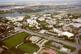
Looking south at College Drive intersecting image in foreground; campus buildngs with Saskatoon and South Saskatchewan River in background.

College Drive intersects image in foreground, with Varsity view neighborhood at bottom. Entire campus at centre.
View looking northeast of campus. Road to President's Residence running along bottom of image; University Hospital at centre. Saskatchewan Research Council building under construction in background centre; University lands and Sutherland also in background.