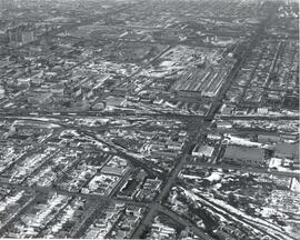
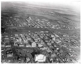
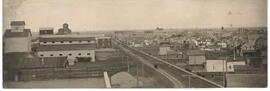
Aerial view of the CP rail-yards and warehouse districts
- CORA-B-874
- Stuk
- ca. 1960
Part of City of Regina fonds
Rail-yards and warehouse district from the air. From Broad Street to Broder Street, Arcola Avenue to outer city limits (north).
28 results with digital objects Show results with digital objects
Aerial view of the CP rail-yards and warehouse districts
Part of City of Regina fonds
Rail-yards and warehouse district from the air. From Broad Street to Broder Street, Arcola Avenue to outer city limits (north).
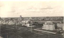
Bird's eye view of Regina downtown core
Part of City of Regina fonds
Birds'-eye view of Regina's downtown core area. View is from Victoria Avenue and Smith Street. Old Laird house is in the foreground. Knox Presbyterian Church is visible.
Part of MJ General Photograph Collection
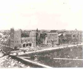
People seen walking around debris in buildings damaged by cyclone in Regina. This image was published in the Moose Jaw Times Herald on May 13, 1955
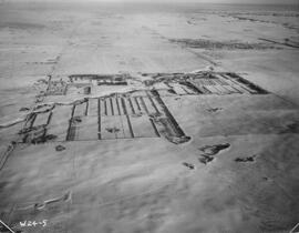
Indian Head Forest Nursery Station.
Part of Agriculture Collection
Aerial view of the Indian Head Forest Nursery Station in 1952.
Zonder titel
Part of City of Regina fonds
Aerial view of downtown Regina (looking north); Hotel Saskatchewan (Victoria Avenue) to northern City Limits; Metropolitan United Church (Lorne Street) to Broad Street.
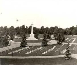
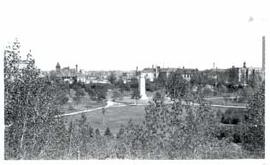
War Memorial, Soldiers' Plot, Regina Cemetery
Part of City of Regina fonds
Aerial view of the War Memorial, Soldiers' Plot at the Regina Cemetery; architectural firm of Portnall and Clemnsha of Regina designed the war memorial.
Zonder titel
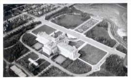
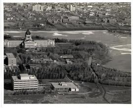
Saskatchewan Legislative Grounds and Wascana Lake
Part of City of Regina fonds
Aerial view of the Saskatchewan Legislative Grounds and Wascana Lake; note that Wascana Lake is drained/empty.
Zonder titel
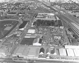
Exhibition Grounds with midway
Part of City of Regina fonds
Aerial view of Exhibition Grounds looking east from Regina Avenue. Midway and buildings in foreground, racetrack to the left.
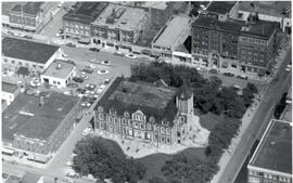
Aerial view of Regina City Hall and Downtown
Part of City of Regina fonds
Aerial view of downtown Regina with Regina City Hall [nicknamed the "Gingerbread Hall"]in centre foreground.
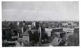
Part of City of Regina fonds
Birds' Eye View of Regina. The view of the south western downtown area is taken from the top of the Canada Life Building. The Knox Metropolitan Church is visible.
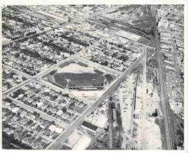
Part of City of Regina fonds
Aerial photograph of Taylor Field (home of the Saskatchewan Roughriders) and surrounding neighbourhood.
Bird's eye view of Regina downtown core
Part of City of Regina fonds
Bird's eye view of Regina downtown core, looking east down South Railway Street. Implement dealers to the left of South Railway, J.I. Case Threshing Machine Co., Massey-Harris, and elevators.
Part of City of Regina fonds
Aerial/birds'-eye view of Victoria Park from the roof of the Regina Library looking east; note: fountain in centre of park has been replaced by the Cenotaph.
Saskatchewan Legislative Building and Grounds
Aerial view of the Saskatchewan Legislative Building and surrounding grounds including part of Wascana Lake in Regina, Saskatchewan
Zonder titel