- FGPC-T-P289
- Item
- [ca. 1930]
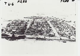
An aerial view of Rosetown taken at a distance from the south looking north, the entire town may be seen in a general layout.

2332 results with digital objects Show results with digital objects
An aerial view of Rosetown taken at a distance from the south looking north, the entire town may be seen in a general layout.
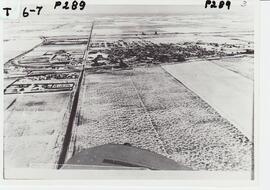
An aerial photo of Rosetown taken in winter taken from the south looking north.

Two-storey house in foreground was the first hospital in Rosetown, Dr. Myers' residence, located at 114 3rd Avenue East. Square house next to it is possibly the McCulloch residence. Believed to be the United Church in the background on the right. Photo taken from the Anglican Church tower.

Photo taken from tower of Anglican Church. Macleods, Clement's Funeral Home, Post Office, Rosetown Bakery (burned down), IGA (burned down). Pioneer elevator in background.
Aerial view of Museum and grounds
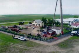
Aerial view shows the Tea House, Fire Hall, School, Church, Blacksmith Shop, tractors, and main buildings. Photographed from a SaskTel balloon in 2008.

An aerial view of Rosetown looking north. Appears to be late fall.
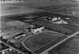
Aerial view of the hospital and nurses residence
An aerial view of the Rosetown Hospital and adjacent nurses residence with St. Joseph's convent beside them.
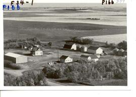
Aerial view of the Scrivens Farm.
Aerial view of the Scrivens Farm, located in the Camberley area, with outbuildings and shelter belt.
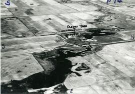
An aerial view of the Trapp Family Dam. A Ducks Unlimited conservation project.

Aerial view of all of Rosetown. South end of town at bottom of photo (elevators visible).
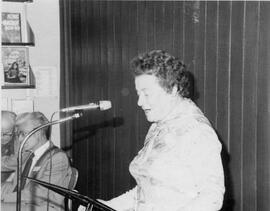
L-R: Frank Glass, Ralph Wiseman, Agnes Wickett at mic. At 50th anniversary celebration in Rosetown Library.
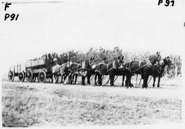
Ahrens hauling grain with mules and horses
Six mules and two horses pulling tandem wagons.
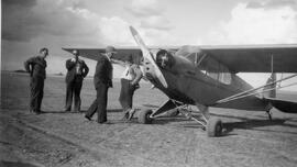
Cliff Hamel and his airplane at first Rosetown Airport. Cliff Hamel, who died in 1958, is shown leaning against the plane. Fred Foursha is possibly the man at the far left.
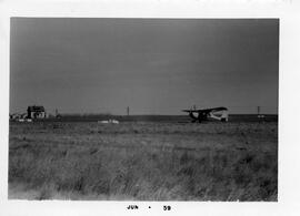
Airplane and the first Rosetown Airport
Looking northwest with Slater farm in the background.
Airplane at first Rosetown airport 1947-69
The airport was located east of 6th Street and south of Marshall Avenue.