
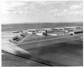
Aerial view of Canadian Forces Base, Moose Jaw
- 68-075
- Item
- [ca. 1965]
Part of MJ General Photograph Collection
Aerial view of buildings and roads at Canadian Forces Base, Moose Jaw
8 results with digital objects Show results with digital objects
Aerial view of Canadian Forces Base, Moose Jaw
Part of MJ General Photograph Collection
Aerial view of buildings and roads at Canadian Forces Base, Moose Jaw

Aerial view of Moose Jaw, Saskatchewan, ca. 1930
Part of MJ General Photograph Collection
Aerial view of Moose Jaw, showing south hill area and many prairie trails leading to city.
Royal Canadian Air Force (R.C.A.F.)
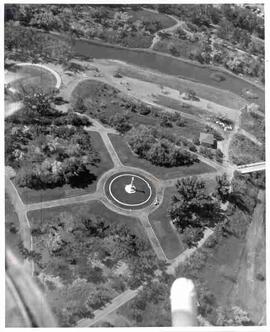
Cenotaph in Crescent Park, Moose Jaw, Saskatchewan
Part of MJ General Photograph Collection
Aerial view of Crescent Park Cenotaph in Moose Jaw, Saskatchewan taken from helicopter
Part of MJ General Photograph Collection
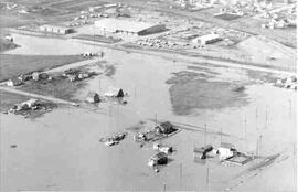
Aerial view of flooding of Thunder Creek in Moose Jaw
Flooding of Thunder Creek at Boharm
Part of MJ General Photograph Collection
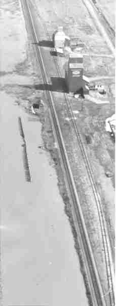
Aerial view of flooding of Thunder Creek at Boharm, Saskatchewan. Flooded land next to railway tracks in foreground; Saskatchewan Pool elevator and unidentified elevator in background
Flooding of Thunder Creek at Boharm
Part of MJ General Photograph Collection
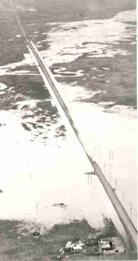
Aerial view of flooding of Thunder Creek on old Highway 1 at Boharm, Saskatchewan. Farmyard in foreground; railway tracks cut through centre of image
Hangars, Canadian Forces Base, Moose Jaw
Part of MJ General Photograph Collection
Hangars at Canadian Forces Base, Moose Jaw
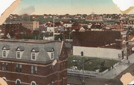
View of Moose Jaw from Main Street, ca. 1910
Part of MJ General Photograph Collection
View Moose Jaw from Main Street, looking northwest toward Central Collegiate; notice horse pasture located on west side of Main Street.