- ZE2.006
- Item
- [1993]
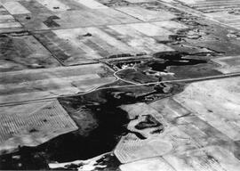
An aerial view of the Blind Creek near Zealandia flooding in the spring. The water flowed west to east and met up with the South Saskatchewan River near Saskatoon.

2 results with digital objects Show results with digital objects
An aerial view of the Blind Creek near Zealandia flooding in the spring. The water flowed west to east and met up with the South Saskatchewan River near Saskatoon.
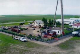
Aerial view of Museum and grounds
Aerial view shows the Tea House, Fire Hall, School, Church, Blacksmith Shop, tractors, and main buildings. Photographed from a SaskTel balloon in 2008.