View of campus looking west; Preston Avenue runs along bottom of image, with campus buildings at centre. East side residential area visible, with College Drive running along left side of image. 25th Street Bridge, river and west side in background.
Aerial view looking northwest with Assiniboine Hall residence on Cumberland Avenue South and University land in foreground. Campus buildings at centre of photograph, with river, city, and prairie in background.
View looking northeast with campus buildings at centre of image. Spadina Crescent East, 25th Street Bridge, and South Saskatchewan River in foreground.
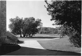
View looking southwest with Physics Building at far right. University buildings in background (from l to r): Administration Building (roof visible); Saskatchewan Hall, Qu'Appelle Hall, and Medical College. Road, landscaping and trees in foreground.
View looking north of Biology Building; students walking on pathway. Trees visible in foreground; Administration Building partially visible in background.
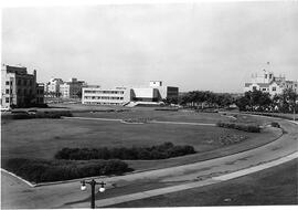
Elevated view from Administration Building looking southwest across the Bowl. University buildings in background (l to r): Qu'Appelle Hall, Medical College, Murray Memorial (Main) Library, and Chemistry Building.
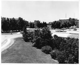
Looking northeast at Field Husbandry (later Crop Science) Building and Engineering Building. Two unidentified women sitting on grass in foreground; cars parked on road.
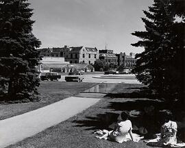
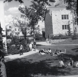
View of sunken garden between Marquis Hall and Qu'Appelle Hall. Students walking on sidewalks and lying on the grass. Biology Building in background across the Bowl.