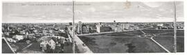
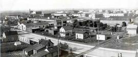
The City of Regina as seen from the top of the Metropolitan Methodist Church. Victoria Park is visible in the left of the frame. Little landscaping has been done to the park.
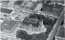
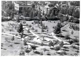
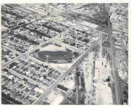
Aerial view of Victoria Park in Regina, looking south towards Victoria Avenue. The Baptist Church and the Land Titles Building are visible and the Victoria Park Fountain is still the centre of Victoria Park (replaced by the World War I Cenotaph in 1928]
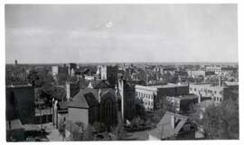
Birds' Eye View of Regina. The view of the south western downtown area is taken from the top of the Canada Life Building. The Knox Metropolitan Church is visible.
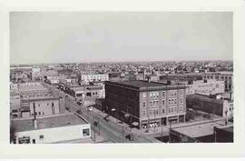
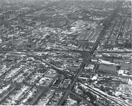
Birds-eye view of downtown Regina, looking east down 11th Avenue. McCallum Hill Building is under construction. Old Post Office is visible in far right of frame.
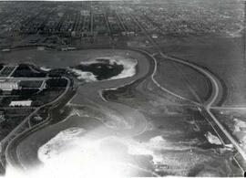
A drained and empty Wascana Lake before it was dredged and deepened in the fall of 1931. As part of a government relief project, 2,100 men (only men who were married and had children were allowed to work on the project) widened and dredged the lake bed and created two islands (Willow and Spruce Island) using only hand tools and horse-drawn wagons.
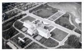
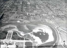
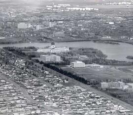
Aerial view looking northeast over the city. The Legislative Buildings, Wascana Lake and Campion College are seen in foreground. From Thornton Avenue to outer city limits (north), Rae Street to east edge of Wascana Park.