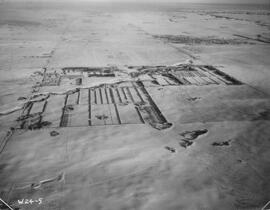
Indian Head Forest Nursery Station.
- IHM.2020.0061
- Pièce
- 1952
Fait partie de Agriculture Collection
Aerial view of the Indian Head Forest Nursery Station in 1952.
Sans titre
Indian Head Forest Nursery Station.
Fait partie de Agriculture Collection
Aerial view of the Indian Head Forest Nursery Station in 1952.
Sans titre
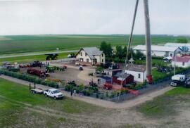
Aerial view of Museum and grounds
Fait partie de Rosetown General Photograph Collection
Aerial view shows the Tea House, Fire Hall, School, Church, Blacksmith Shop, tractors, and main buildings. Photographed from a SaskTel balloon in 2008.
Fait partie de MJ General Photograph Collection
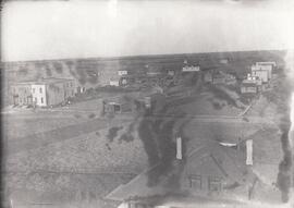
Aerial view of Tuxford, Saskatchewan ‘in the early years’.
Fait partie de Rosetown General Photograph Collection
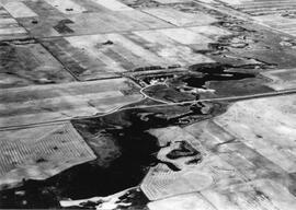
An aerial view of the Blind Creek near Zealandia flooding in the spring. The water flowed west to east and met up with the South Saskatchewan River near Saskatoon.

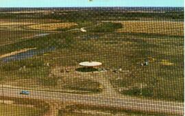
Aerial View of the Melfort Research Farm
Fait partie de Melfort General Photo collection
An aerial view of the Melfort Research Farm in the winter time.
Fait partie de University of Saskatchewan Photograph Collection
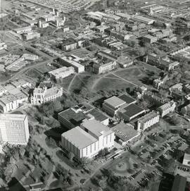
Looking northwest across campus; river and city in the distance.
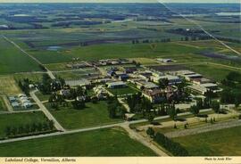
Lakeland College, Vermilion, Alberta
Fait partie de LRA Photograph Collection
Aerial view of Lakeland College campus in Vermilion, Alberta.
Fait partie de University of Saskatchewan Photograph Collection
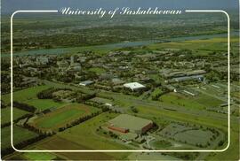
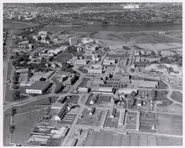
View looking northeast with College Drive running along bottom of image. Physical Education building, Hangar Building, and greenhouses in foreground, with surrounding campus buildings and fields in background.
Fait partie de LRA Photograph Collection
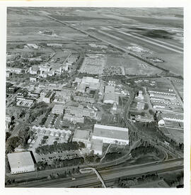
Aerial view of Dai's Petland & Esso Service station.
Fait partie de University of Saskatchewan Photograph Collection
View looking northwest with the Bowl and surrounding campus buildings at centre.
Fait partie de University of Saskatchewan Photograph Collection
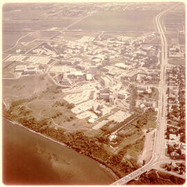
View of campus at centre; South Saskatchewan River and 25th Street Bridge at bottom; University lands and Sutherland in background. College Drive running at right of image.
Fait partie de University of Saskatchewan Photograph Collection
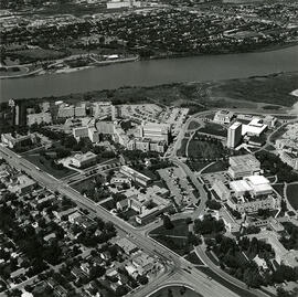
View looking northwest of campus; houses on College Drive running along bottom left of image.Robin Hood Flour Mills elevator at top of image.
Fait partie de University of Saskatchewan Photograph Collection
View facing west with barns and feed (grain) elevator in foreground, the Bowl and surrounding buildings at centre. Construction of the Western College of Veterinary Medicine underway.
Fait partie de University of Saskatchewan Photograph Collection
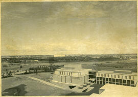
Aerial view looking northwest of Law Building; Robin Hood Mills elevator in background.
Bio/Historical Note: The Law and Commerce Buildings were designed and constructed as part of a single project between 1965 and 1967. The architect was John Holliday-Scott of the Saskatoon firm Holliday-Scott & Associates.
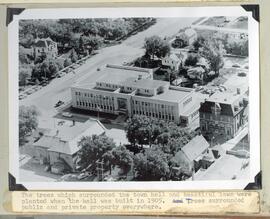
Aerial view and grounds the Yorkton Town hall
Fait partie de Howard Jackson Collection
The trees and lawn which surrounded the Town hall