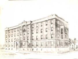
Artist's drawing of Regina Hospital
- CORA-B-405
- Item
- [198-]
Part of City of Regina fonds
Photograph of the artist's drawing of Regina General Hospital from [1910?].
472 results with digital objects Show results with digital objects
Artist's drawing of Regina Hospital
Part of City of Regina fonds
Photograph of the artist's drawing of Regina General Hospital from [1910?].
Part of City of Regina fonds
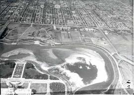
A drained and empty Wascana Lake before it was dredged and deepened in the fall of 1931. As part of a government relief project, 2,100 men (only men who were married and had children were allowed to work on the project) widened and dredged the lake bed and created two islands (Willow and Spruce Island) using only hand tools and horse-drawn wagons.
Part of City of Regina fonds
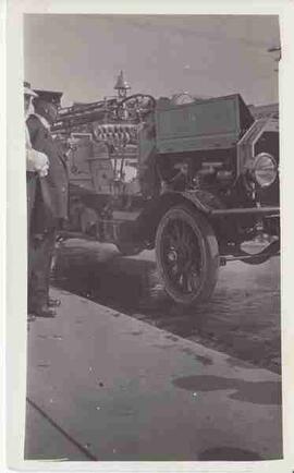
An early fire engine on display with the Fire Chief looking at it.
Part of City of Regina fonds
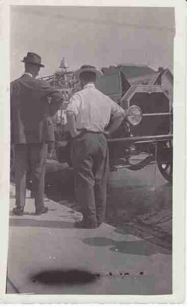
An early fire engine on display with two men looking at the engine
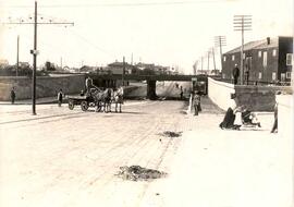
Albert Street underpass in Regina, near completion
Part of City of Regina fonds
Nearly complete Albert Street underpass with workmen posing as they finish sweeping dirt over the bricks on the street.; looking north up Albert Street from South Railway Avenue (now Saskatchewan Drive)
Part of City of Regina fonds
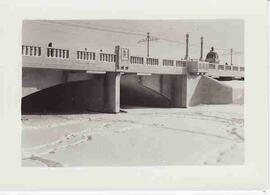
Albert Street Bridge and dam, February 1938
Hall, A.C.V.
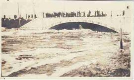
Albert Street Bridge during the flood
Part of City of Regina fonds
Water level under the Albert Street Bridge with crowd of people on the bridge during the Wascana Flood of 1915.
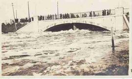
Albert Street Bridge during the flood
Part of City of Regina fonds
Water level under the Albert Street Bridge with crowd of people on the bridge during the Wascana Flood of 1915.
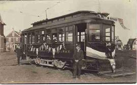
Albert and Broad Street streetcar
Part of City of Regina fonds
Two unidentified city employees posed in front of Albert Street and Broad Street streetcar.
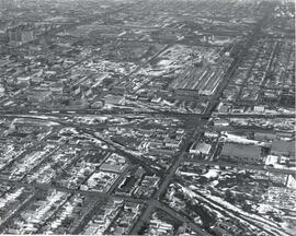
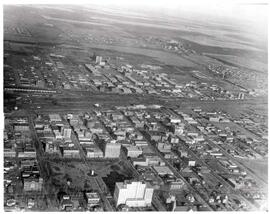
Aerial view of the CP rail-yards and warehouse districts
Part of City of Regina fonds
Rail-yards and warehouse district from the air. From Broad Street to Broder Street, Arcola Avenue to outer city limits (north).
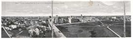
Aerial view of Regina, Saskatchewan
Part of City of Regina fonds
The City of Regina as seen from the top of the Metropolitan Methodist Church. Victoria Park is visible in the left of the frame. Little landscaping has been done to the park.
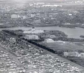
Aerial view of Regina looking northeast
Part of City of Regina fonds
Aerial view looking northeast over the city. The Legislative Buildings, Wascana Lake and Campion College are seen in foreground. From Thornton Avenue to outer city limits (north), Rae Street to east edge of Wascana Park.
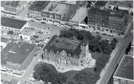
Aerial view of Regina City Hall and Downtown
Part of City of Regina fonds
Aerial view of downtown Regina with Regina City Hall [nicknamed the "Gingerbread Hall"]in centre foreground.
Part of City of Regina fonds
Aerial view of downtown Regina (looking north); Hotel Saskatchewan (Victoria Avenue) to northern City Limits; Metropolitan United Church (Lorne Street) to Broad Street.
Part of City of Regina fonds
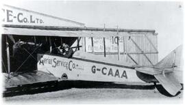
Plane and hangar at Aerial Service Co. Ltd., Canada's first licensed aerodrome.