- RG2024-2006-086-526
- Item
- 1983
Parte deEducational Media Access and Production (EMAP) fonds
Aerial views of campus
Parte deEducational Media Access and Production (EMAP) fonds
Aerial views of campus
Parte deEducational Media Access and Production (EMAP) fonds
Aerial views of campus
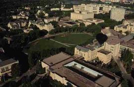
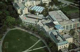
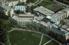
Parte deEducational Media Access and Production (EMAP) fonds
Aerial view of U of S Bowl and adjacent buildings.
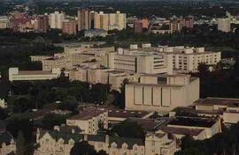
Parte deEducational Media Access and Production (EMAP) fonds
Aerial view of Health Sciences Building and Royal University Hospital with downtown Saskatoon in background.
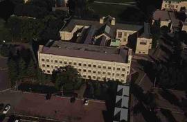
Parte deEducational Media Access and Production (EMAP) fonds
Aerial view of Administration/College Buildings.
Parte deEducational Media Access and Production (EMAP) fonds
Aerial view of City of Saskatoon; includes Griffiths Stadium and U of S Campus.
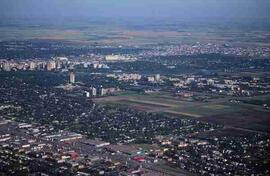
Parte deEducational Media Access and Production (EMAP) fonds
Aerial view of City of Saskatoon; includes Griffiths Stadium and U of S Campus.
Parte deEducational Media Access and Production (EMAP) fonds
Parte deEducational Media Access and Production (EMAP) fonds
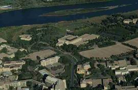
Parte deEducational Media Access and Production (EMAP) fonds
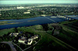
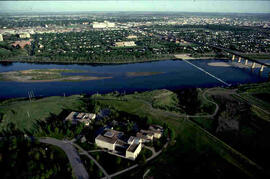
Aerial of Campus from south with surrounding city, river and bridges.
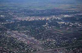
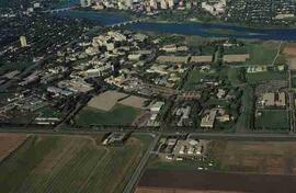
Parte deEducational Media Access and Production (EMAP) fonds
Aerial of northeast campus with surrounding city and river.
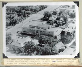
Aerial view and grounds the Yorkton Town hall
Parte deHoward Jackson Collection
The trees and lawn which surrounded the Town hall
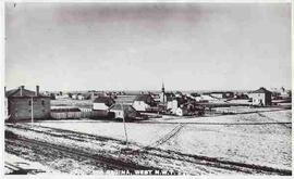
Parte deCity of Regina fonds
Aerial view of downtown Regina (looking north); Hotel Saskatchewan (Victoria Avenue) to northern City Limits; Metropolitan United Church (Lorne Street) to Broad Street.
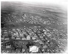
Parte deCity of Regina fonds
Bird's eye view of Regina's downtown core
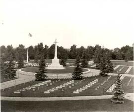
War Memorial, Soldiers' Plot, Regina Cemetery
Parte deCity of Regina fonds
Aerial view of the War Memorial, Soldiers' Plot at the Regina Cemetery; architectural firm of Portnall and Clemnsha of Regina designed the war memorial.
Sin título