- CORA-A-548
- Item
- 1937
Parte de City of Regina fonds
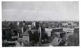
Birds' Eye View of Regina. The view of the south western downtown area is taken from the top of the Canada Life Building. The Knox Metropolitan Church is visible.
Parte de City of Regina fonds
Birds' Eye View of Regina. The view of the south western downtown area is taken from the top of the Canada Life Building. The Knox Metropolitan Church is visible.
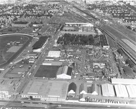
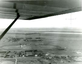
Exhibition Grounds with midway
Parte de City of Regina fonds
Aerial view of Exhibition Grounds looking east from Regina Avenue. Midway and buildings in foreground, racetrack to the left.
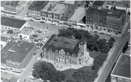
Aerial view of Regina City Hall and Downtown
Parte de City of Regina fonds
Aerial view of downtown Regina with Regina City Hall [nicknamed the "Gingerbread Hall"]in centre foreground.
Parte de LRA Photograph Collection
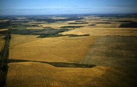
Aerial view of highway 17 and wheat fields.
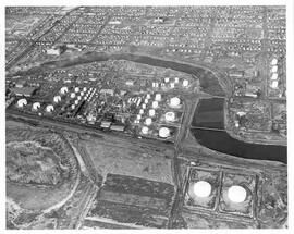
Aerial view of British American Oil Refinery in Moose Jaw, Saskatchewan
Parte de MJ General Photograph Collection
Aerial view of the British American Oil Co. Refinery and surrounding area near the Moose Jaw River in Moose Jaw, Saskatchewan. Union Hospital and St. Margaret's Catholic School are visible in photograph as well.
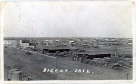
Aerial view of Biggar, Saskatchewan
Parte de Biggar Photograph Collection
Aerial view of Biggar, Saskatchewan from the east end of Railway Avenue
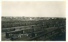
Canadian National Railyard in Biggar, Saskatchewan
Parte de Biggar Photograph Collection
An aerial view of the Canadian National rail yard with the town of Biggar, Saskatchewan in the background
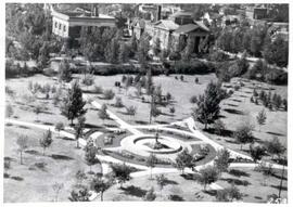
Birds'-eye view of Victoria Park in Regina
Parte de City of Regina fonds
Aerial view of Victoria Park in Regina, looking south towards Victoria Avenue. The Baptist Church and the Land Titles Building are visible and the Victoria Park Fountain is still the centre of Victoria Park (replaced by the World War I Cenotaph in 1928]
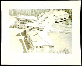
Parte de Prince Albert Sanatorium fonds
Aerial photograph of the Prince Albert Sanatorium
Sem título
Aerial photo of Indian Head from the southeast
Parte de Town Collection
Photograph taken from an airplane looking northwest with the railway in the foreground and looking directly up Grand Avenue
Aerial photo of Indian Head Collegiate and former airport
Parte de Town Collection
Photograph taken from an airplane looking northeast over the Indian Head Collegiate (high school) to the former airport - now Indian Head Golf Course.
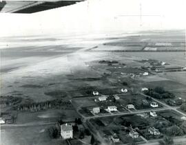
Aerial photo of Indian Head from the north
Parte de Town Collection
Photograph taken from an airplane looking south toward Indian Head. The Experimental Farm barn and office building are on the far left of the photograph.
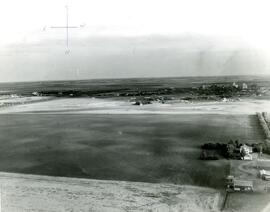
Aerial photo of Indian Head horse race track and former airport
Parte de Town Collection
Photograph taken from an airplane looking north over the fairgrounds/horse race track to the former airport - now Indian Head Golf Course.
Parte de Town Collection
Looking over Indian Head, you can see the Gordon Hotel as well the Methodist Church and, in the distance, the original Presbyterian Church.

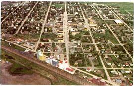
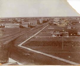
Bird's Eye View of Indian Head, looking North
Parte de Town Collection
Coloured postcard of Indian head taken from the top of a grain elevator. Flour mill building is to the right.