- A-10305
- Item
- Sept. 1972
View looking west with Rutherford Rink at centre of image; campus buildings in foreground. College Drive runs along left of photograph. 25th Street Bridge, river and west side in background.
376 results with digital objects Show results with digital objects
View looking west with Rutherford Rink at centre of image; campus buildings in foreground. College Drive runs along left of photograph. 25th Street Bridge, river and west side in background.
View looking northwest with Griffiths Stadium and University land in foreground. University Hospital and surrounding buildings at centre of image; South Saskatchewan River, 25th Street Bridge, and city in background. College Drive runs through centre.
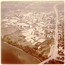
View looking southwest with Arts Tower at centre, with surrounding campus buildings in foreground. 25th Street Bridge, South Saskatchewan River and west side in background.
View looking west of campus buildings at centre; University (25th Street Bridge), river, and west side residential areas in background. College Drive runs along left of image, and Preston Avenue runs along bottom.
View of looking north campus buildings at centre, with east side residential area and Griffiths Stadium partially visible in foreground. College Drive runs along bottom of image, with University lands and prairie in background.
View of campus at centre; South Saskatchewan River and 25th Street Bridge at bottom; University lands and Sutherland in background. College Drive running at right of image.
View of College Drive and east side residential areas at bottom of image. Campus at centre, with University lands and Sutherland in background.
View of campus at centre of image; Preston Avenue and University lands at bottom.
View looking southeast with campus and east side residential areas at centre of image. University lands at bottom; river and west side residential areas in background.
Fort San Building Image Collection
Part of Fort San fonds
Collection contains exterior and interior images of the Fort San Sanatorium.
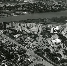
View of campus looking northeast; east side residential area, 25th Street Bridge and South Saskatchewan River in foreground. Campus building at centre of image, with College Drive intersecting image.
View of campus looking west; Preston Avenue runs along bottom of image, with campus buildings at centre. East side residential area visible, with College Drive running along left side of image. 25th Street Bridge, river and west side in background.
Fonds contains records and photos of the Fort Qu'Appelle Sanatorium, generally referred to as "Fort San".
Saskatchewan Anti-Tuberculosis League
View looking northwest of campus; houses on College Drive running along bottom left of image.Robin Hood Flour Mills elevator at top of image.
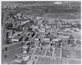
View facing west with barns and feed (grain) elevator in foreground, the Bowl and surrounding buildings at centre. Construction of the Western College of Veterinary Medicine underway.