Aerial View of The Rural Municipality of Biggar #347
- 02.710.22K
- Item
- ca.1957
Parte deBiggar Photograph Collection
An aerial view of TP 37 RG 16/15 in the Rural Municipality of Biggar # 347
Sin título
376 resultados con objetos digitales Muestra los resultados con objetos digitales
Aerial View of The Rural Municipality of Biggar #347
Parte deBiggar Photograph Collection
An aerial view of TP 37 RG 16/15 in the Rural Municipality of Biggar # 347
Sin título
Aerial View of The Rural Municipality of Biggar #347
Parte deBiggar Photograph Collection
An aerial view of TP 37/36 RG 15 in the Rural Municipality of Biggar # 347
Sin título
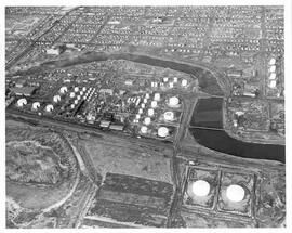
Aerial view of British American Oil Refinery in Moose Jaw, Saskatchewan
Parte deMJ General Photograph Collection
Aerial view of the British American Oil Co. Refinery and surrounding area near the Moose Jaw River in Moose Jaw, Saskatchewan. Union Hospital and St. Margaret's Catholic School are visible in photograph as well.
Aerial View of The Rural Municipality of Biggar #347
Parte deBiggar Photograph Collection
An aerial view of TP 37 RG 15/14 in the Rural Municipality of Biggar # 347
Sin título
Aerial View of The Rural Municipality of Biggar #347
Parte deBiggar Photograph Collection
An aerial view of TP 38/37 RG 16/15 in the Rural Municipality of Biggar # 347
Sin título
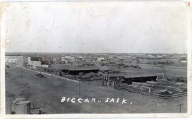
Aerial view of Biggar, Saskatchewan
Parte deBiggar Photograph Collection
Aerial view of Biggar, Saskatchewan from the east end of Railway Avenue
Aerial View of The Rural Municipality of Biggar #347
Parte deBiggar Photograph Collection
An aerial view of TP 37 RG 15 in the Rural Municipality of Biggar # 347
Sin título
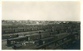
Canadian National Railyard in Biggar, Saskatchewan
Parte deBiggar Photograph Collection
An aerial view of the Canadian National rail yard with the town of Biggar, Saskatchewan in the background
View of the Bowl with Arts Building, Murray Memorial (Main) Library, Thorvaldson Building, Biology Building, Physics Building, Administration Building, Saskatchewan Hall, Qu'Appelle Hall, Physical Education Building, and other campus buildings visible.
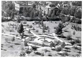
Birds'-eye view of Victoria Park in Regina
Parte deCity of Regina fonds
Aerial view of Victoria Park in Regina, looking south towards Victoria Avenue. The Baptist Church and the Land Titles Building are visible and the Victoria Park Fountain is still the centre of Victoria Park (replaced by the World War I Cenotaph in 1928]
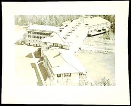
Parte dePrince Albert Sanatorium fonds
Aerial photograph of the Prince Albert Sanatorium
Sin título
Parte dePrince Albert Sanatorium fonds
File contains aerial photographs of the Prince Albert Sanatorium.
Sin título
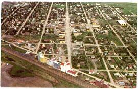
Aerial photo of Indian Head from the southeast
Parte deTown Collection
Photograph taken from an airplane looking northwest with the railway in the foreground and looking directly up Grand Avenue
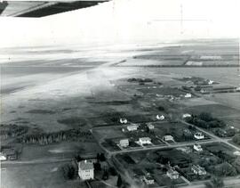
Aerial photo of Indian Head Collegiate and former airport
Parte deTown Collection
Photograph taken from an airplane looking northeast over the Indian Head Collegiate (high school) to the former airport - now Indian Head Golf Course.
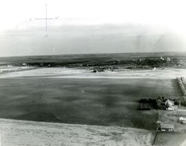
Aerial photo of Indian Head from the north
Parte deTown Collection
Photograph taken from an airplane looking south toward Indian Head. The Experimental Farm barn and office building are on the far left of the photograph.