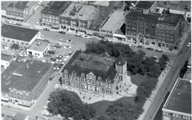
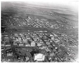
Aerial view of Regina City Hall and Downtown
- CORA-A-1482
- Pièce
- [ca. 1940s-1950s]
Fait partie de City of Regina fonds
Aerial view of downtown Regina with Regina City Hall [nicknamed the "Gingerbread Hall"]in centre foreground.

31 résultats avec objets numériques Afficher les résultats avec des objets numériques
Aerial view of Regina City Hall and Downtown
Fait partie de City of Regina fonds
Aerial view of downtown Regina with Regina City Hall [nicknamed the "Gingerbread Hall"]in centre foreground.
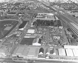
Exhibition Grounds with midway
Fait partie de City of Regina fonds
Aerial view of Exhibition Grounds looking east from Regina Avenue. Midway and buildings in foreground, racetrack to the left.
Fait partie de City of Regina fonds
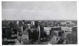
Birds' Eye View of Regina. The view of the south western downtown area is taken from the top of the Canada Life Building. The Knox Metropolitan Church is visible.
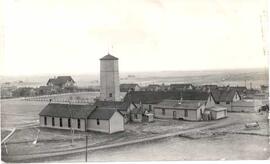
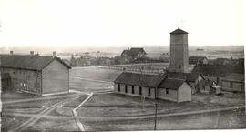
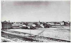
North West Mounted Police (NWMP) Barracks
Fait partie de City of Regina fonds
North West Mounted Police barracks, birds'-eye view
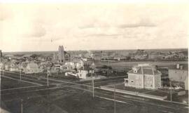
Birds'-Eye view of the North-West Mounted Police (NWMP) yard
Fait partie de City of Regina fonds
Birds'-Eye view of the North-West Mounted Police (NWMP) yard and buildings
Fait partie de City of Regina fonds
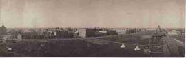
Regina's downtown from the air. Victoria Park to left middle, gingerbread City Hall to middle, roundhouse to right middle. The area from 12th Avenue to South Railway Street, Pasqua Street to Halifax Street is seen.
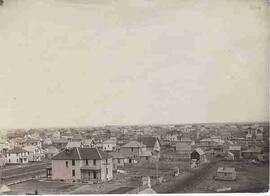
Bird's eye view of Regina downtown core
Fait partie de City of Regina fonds
Birds'-eye view of Regina's downtown core area. View is from Victoria Avenue and Smith Street. Old Laird house is in the foreground. Knox Presbyterian Church is visible.
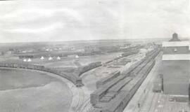
Bird's eye view of Regina CPR yards
Fait partie de City of Regina fonds
Bird's eye view of early Regina downtown core. Canadian Pacific Railway Yards.
Bird's eye view of Stanley Park & South Railway
Fait partie de City of Regina fonds
Bird's eye view of Stanley Park and South Railway Street. Looking southwest from the CPR station.
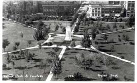
Victoria Park with Cenotaph, Regina
Fait partie de City of Regina fonds
Aerial/birds' eye view of Victoria Park and Cenotaph facing towards 12th Avenue and Cornwall Street.
Fait partie de City of Regina fonds
Aerial/bird's-eye view of Victoria Park looking southeast; band shell & cricket pitch in foreground.
Fait partie de City of Regina fonds
Aerial view of downtown Regina (looking north); Hotel Saskatchewan (Victoria Avenue) to northern City Limits; Metropolitan United Church (Lorne Street) to Broad Street.
Fait partie de City of Regina fonds
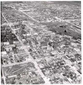
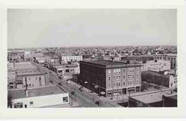
Bird's eye view of Regina's downtown core
Bird's eye view of Regina's downtown core
Fait partie de City of Regina fonds
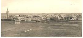
Bird's eye view of Regina downtown core in the early 1900s.
Fait partie de City of Regina fonds
Looking west down 11th Avenue from the corner of 11th Avenue and Cornwall Street