
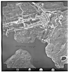
Aerial photo of Uranium City, Saskatchewan
- A. General files. Uranium City. Air photos, Uranium City and El Dorado - 1959-1960.
- Stuk
- June 6, 1960
Part of R.M. Bone fonds
Aerial view of Uranium City, Saskatchewan.
Zonder titel
50 results with digital objects Show results with digital objects
Aerial photo of Uranium City, Saskatchewan
Part of R.M. Bone fonds
Aerial view of Uranium City, Saskatchewan.
Zonder titel
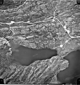
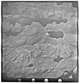
Aerial photo of Uranium City, Sask.
Part of R.M. Bone fonds
Series of 43 mosaic photos. At bottom of image: "5717-AB-1-1-3" On back of image: "Job P 1613/59 / Roll 5717 / Flight Altitude - 7000 feet AMSL / Focal Length - 152.53 mm / Date of Photography - June 6 1960 / Time (GMT) 1220-1225 HRS / Photography by Hunting Survey Corporation Limited Toronto, Canada / Copyright - The Province of Saskatchewan Department of Highways"
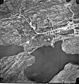
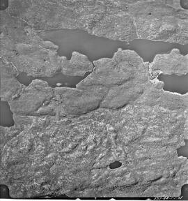
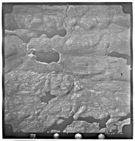
Aerial photo of Uranium City, Sask.
Part of R.M. Bone fonds
Series of 43 mosaic photos. At bottom of image: "5717-AB-1-1-5" On back of image: "Job P 1613/59 / Roll 5717 / Flight Altitude - 7000 feet AMSL / Focal Length - 152.53 mm / Date of Photography - June 6 1960 / Time (GMT) 1220-1225 HRS / Photography by Hunting Survey Corporation Limited Toronto, Canada / Copyright - The Province of Saskatchewan Department of Highways"
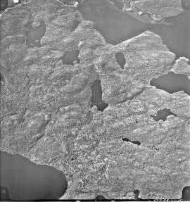
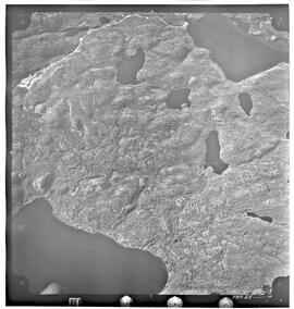
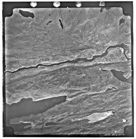
Aerial photo of Uranium City, Sask.
Part of R.M. Bone fonds
Series of 43 mosaic photos. At bottom of image: "5717-AB-1-1-15" On back of image: "Job P 1613/59 / Roll 5717 / Flight Altitude - 7000 feet AMSL / Focal Length - 152.53 mm / Date of Photography - June 6 1960 / Time (GMT) 1220-1225 HRS / Photography by Hunting Survey Corporation Limited Toronto, Canada / Copyright - The Province of Saskatchewan Department of Highways"
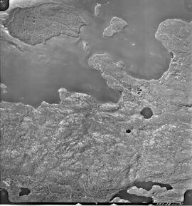
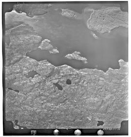
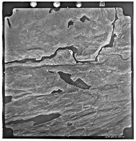
Aerial photo of Uranium City, Sask.
Part of R.M. Bone fonds
Series of 43 mosaic photos. At bottom of image: "5717-AB-1-1-21" On back of image: "Job P 1613/59 / Roll 5717 / Flight Altitude - 7000 feet AMSL / Focal Length - 152.53 mm / Date of Photography - June 6 1960 / Time (GMT) 1220-1225 HRS / Photography by Hunting Survey Corporation Limited Toronto, Canada / Copyright - The Province of Saskatchewan Department of Highways"
Aerial photo of Uranium City, Sask.
Part of R.M. Bone fonds
Series of 43 mosaic photos. At bottom of image: "5717-AB-1-1-27" On back of image: "Job P 1613/59 / Roll 5717 / Flight Altitude - 7000 feet AMSL / Focal Length - 152.53 mm / Date of Photography - June 6 1960 / Time (GMT) 1220-1225 HRS / Photography by Hunting Survey Corporation Limited Toronto, Canada / Copyright - The Province of Saskatchewan Department of Highways"
Aerial photo of Uranium City, Sask.
Part of R.M. Bone fonds
Series of 43 mosaic photos. At bottom of image: "5717-AB-1-1-8" On back of image: "Job P 1613/59 / Roll 5717 / Flight Altitude - 7000 feet AMSL / Focal Length - 152.53 mm / Date of Photography - June 6 1960 / Time (GMT) 1220-1225 HRS / Photography by Hunting Survey Corporation Limited Toronto, Canada / Copyright - The Province of Saskatchewan Department of Highways"
Aerial photo of Uranium City, Sask.
Part of R.M. Bone fonds
Series of 43 mosaic photos. At bottom of image: "5717-AB-1-1-14" On back of image: "Job P 1613/59 / Roll 5717 / Flight Altitude - 7000 feet AMSL / Focal Length - 152.53 mm / Date of Photography - June 6 1960 / Time (GMT) 1220-1225 HRS / Photography by Hunting Survey Corporation Limited Toronto, Canada / Copyright - The Province of Saskatchewan Department of Highways"
Aerial photo of Uranium City, Sask.
Part of R.M. Bone fonds
Series of 43 mosaic photos. At bottom of image: "5717-AB-1-1-18" On back of image: "Job P 1613/59 / Roll 5717 / Flight Altitude - 7000 feet AMSL / Focal Length - 152.53 mm / Date of Photography - June 6 1960 / Time (GMT) 1220-1225 HRS / Photography by Hunting Survey Corporation Limited Toronto, Canada / Copyright - The Province of Saskatchewan Department of Highways"
Aerial photo of Uranium City, Sask.
Part of R.M. Bone fonds
Series of 43 mosaic photos. At bottom of image: "5717-AB-1-1-28" On back of image: "Job P 1613/59 / Roll 5717 / Flight Altitude - 7000 feet AMSL / Focal Length - 152.53 mm / Date of Photography - June 6 1960 / Time (GMT) 1220-1225 HRS / Photography by Hunting Survey Corporation Limited Toronto, Canada / Copyright - The Province of Saskatchewan Department of Highways"
Aerial photo of Uranium City, Sask.
Part of R.M. Bone fonds
Series of 43 mosaic photos. At bottom of image: "5717-AB-1-1-30" On back of image: "Job P 1613/59 / Roll 5717 / Flight Altitude - 7000 feet AMSL / Focal Length - 152.53 mm / Date of Photography - June 6 1960 / Time (GMT) 1220-1225 HRS / Photography by Hunting Survey Corporation Limited Toronto, Canada / Copyright - The Province of Saskatchewan Department of Highways"
Aerial photo of Uranium City, Sask.
Part of R.M. Bone fonds
Series of 4 mosaic photos. At bottom of image: "5690-RC-6-22-12" On back of image: "Job P 1613/59 / Roll 5690 / Flight Altitude - 7000 feet AMSL / Focal Length - 152.53 mm / Date of Photography - May 30 1960 / Time (GMT) HRS / Photography by Hunting Survey Corporation Limited Toronto, Canada / Copyright - The Province of Saskatchewan Department of Highways"
Aerial photo of Uranium City, Sask.
Part of R.M. Bone fonds
Series of 4 mosaic photos. At bottom of image: "5690-RC-6-22-14" On back of image: "Job P 1613/59 / Roll 5690 / Flight Altitude - 7000 feet AMSL / Focal Length - 152.53 mm / Date of Photography - May 30 1960 / Time (GMT) HRS / Photography by Hunting Survey Corporation Limited Toronto, Canada / Copyright - The Province of Saskatchewan Department of Highways"
Flight plan of La Ronge, Sask.
Part of R.M. Bone fonds
Map of flight plan for aerial photos of La Ronge; shows physical features; "C3-La Ronge and Air Ronge 1:5000 G 60521 20-5-76".
Lots and Blocks in Air Ronge, Sask.
Part of R.M. Bone fonds
Part I - description of lot and block breakdown showing residents of Air Ronge. Part II - map indicating growth of Air Ronge.