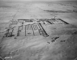
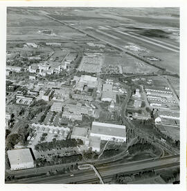
Indian Head Forest Nursery Station.
- IHM.2020.0061
- Item
- 1952
Parte de Agriculture Collection
Aerial view of the Indian Head Forest Nursery Station in 1952.
Sem título
376 resultados com objetos digitais Mostrar resultados com objetos digitais
Indian Head Forest Nursery Station.
Parte de Agriculture Collection
Aerial view of the Indian Head Forest Nursery Station in 1952.
Sem título
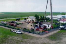
Aerial view of Museum and grounds
Aerial view shows the Tea House, Fire Hall, School, Church, Blacksmith Shop, tractors, and main buildings. Photographed from a SaskTel balloon in 2008.
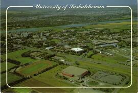
View of campus; South Saskatchewan River, bridges, Innovation Place, Preston Crossing and several residential neighbourhoods visible in background.
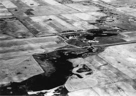
An aerial view of the Blind Creek near Zealandia flooding in the spring. The water flowed west to east and met up with the South Saskatchewan River near Saskatoon.
A series of four views of campus taken from the east side of the Arts Tower. Thorvaldson Building and Agriculture Building are visible.

Aerial View of the Melfort Research Farm
Parte de Melfort General Photo collection
An aerial view of the Melfort Research Farm in the winter time.
Looking northwest across campus; river and city in the distance.
View of campus with Innovation Place, farm land and CPR and Circle Drive Bridges visible.
The Bowl at centre of image with surrounding campus buildings.
View of the Bowl with Arts Building, Murray Memorial (Main) Library, Thorvaldson Building, Biology Building, Physics Building, Administration Building, Saskatchewan Hall, Qu'Appelle Hall, Physical Education Building, and other campus buildings visible.
Looking southwest across campus with Crop Development Centre in foreground; College Drive running through at centre.
View looking northeast with College Drive running along bottom of image. Physical Education building, Hangar Building, and greenhouses in foreground, with surrounding campus buildings and fields in background.
View looking northwest with College Drive running along bottom of image. The Bowl at centre; with surrounding buildings; South Saskatchewan River and city in background.
View looking northwest with partial view of Griffiths Stadium and tennis courts in foreground. The Bowl is at centre of image, with surrounding campus buildings.
View looking northwest with partial view of Griffiths Stadium, tennis courts, and College Drive running along bottom of image. The Bowl is at centre with surrounding buildings; river and city in background.