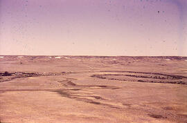
Open Glory hole in Porphyry, gold mine, Ruby Gulch
- WOK 1-86
- Item
- 1953
Part of W.O. Kupsch fonds
Open Glory hole in Porphyry, gold mine, Ruby Gulch, Little Rocky Mountains, Montana.
71 results directly related Exclude narrower terms
Open Glory hole in Porphyry, gold mine, Ruby Gulch
Part of W.O. Kupsch fonds
Open Glory hole in Porphyry, gold mine, Ruby Gulch, Little Rocky Mountains, Montana.
Missouri River near Wolf Point, Montana
Part of W.O. Kupsch fonds
Missouri River near Wolf Point, Montana. Fort Union (Paleocene) highland in background. Identity of individuals in photograph unknown.
Mission Canyon, Little Rocky Mountains, Montana
Part of W.O. Kupsch fonds
Mission Canyon, Little Rocky Mountains, Montana.
Mission Canyon, Little Rocky Mountains, Montana
Part of W.O. Kupsch fonds
Mission Canyon, Little Rocky Mountains, Montana
Mission Canyon, Little Rocky Mountains
Part of W.O. Kupsch fonds
Mission Canyon, Little Rocky Mountains.
Meandering River in Frenchman Valley near Watson's Bridge
Part of W.O. Kupsch fonds
Meandering River in Frenchman Valley near Watson's Bridge looking south; one can also see the prominent white band: Whitebud formation (Upper Cretaceous)
Kupsch, Walter Oscar
Map of the Netherlands, 16th century
Part of W.O. Kupsch fonds
Map of the Netherlands during the 16th century. Shows the land area and drainage channels.
Map of the Netherlands during Roman times
Part of W.O. Kupsch fonds
Map of the Netherlands during Roman times showing land area and river channels.
Lodgepole Canyon, Little Rocky Mountains, Montana
Part of W.O. Kupsch fonds
Lodgepole Canyon, Little Rocky Mountains, Montana.
Lodgepole Canyon, Little Rocky Mountains
Part of W.O. Kupsch fonds
Lodgepole Canyon, Little Rocky Mountains
Lodgepole Canyon, Little Rocky Mountains
Part of W.O. Kupsch fonds
Lodgepole Canyon, Little Rocky Mountains, Montana. Identity of individual in photograph unknown.
Little Missouri River in Badlands, Theodore Roosevelt Park
Part of W.O. Kupsch fonds
Badlands in Theodore Roosevelt Park, N.D showing Little Missouri River
Large boulder in finer gravel. Flaxville formation
Part of W.O. Kupsch fonds
Large boulder in finer gravel. Flaxville formation. Near Orpheim, Montana.
Kepperlites sp. Rierdon formation. Morrison Dome.
Part of W.O. Kupsch fonds
Kepperlites sp. Rierdon formation. Morrison Dome, Montana.
This fonds contains material documenting the career of Ka-Iu Fung, including correspondence with colleagues, teaching materials, and research material, including that compiled for the two "Atlas of Saskatchewan" projects.
Fung, Kai-Iu, 1935- ; (Professor of Geography)