Aerial view of northern Baffin Island
- WOK 20-3
- Item
- 1965
Part of W.O. Kupsch fonds
Citation reads: "Aerial view of northern Baffin Island, August 16, 1965."
37939 results with digital objects Show results with digital objects
Aerial view of northern Baffin Island
Part of W.O. Kupsch fonds
Citation reads: "Aerial view of northern Baffin Island, August 16, 1965."
Aerial view of northern Baffin Island
Part of W.O. Kupsch fonds
Citation reads: "Aerial view of nice cap in distance, fiords in foreground, northern Baffin Island, August 16, 1965."
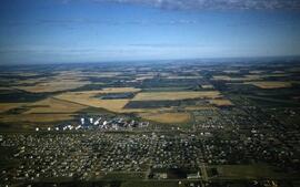
Aerial view of northwest quadrant of Lloydminster
Part of LRA Photograph Collection
View of Northwest portion of Lloydminster with the old Catholic Church in foreground
Aerial view of Nutana SuburbCentre Development
Part of Saskatoon StarPhoenix fonds
Photograph shows an aerial view of Nutana Suburban Centre Development, September 25, 1964.
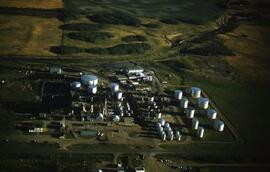
Part of LRA Photograph Collection
Canadian Kodiak Refineries
Aerial view of outwash train formed in re-entrant
Part of W.O. Kupsch fonds
Aerial photograph of outwash train formed in re-entrant. Note V-shaped indentation of washboard moraines. Stream depositing outwash material flowed east. Sec. 31, T. 10, R. 8, W. 2.
Aerial view of overlap of washboard moraines
Part of W.O. Kupsch fonds
Aerial photograph of overlap of washboard moraines. This prbably indicates local readvance of the ice from the west. Sec. 11, R. 11, T. 9, W. 2.
Aerial view of overlap of washboard moraines
Part of W.O. Kupsch fonds
Aerial photograph of overlap of washboard moraines. This prbably indicates locak readvance of the ice from the west. Sec. 11, R. 11, T. 9, W. 2.
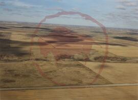
Aerial view of parabolic and complex dunes in Great Sand Hills area
Part of W.O. Kupsch fonds
Dunes. Parabolic and complex dunes in Great Sand Hills area. Wind direction from west. Active dunes are white, stabilised dunes grey. Location: sec. 16, T. 20, R. 24, W. 3, Sask.
Aerial view of Potash Company of America plant east of city
Part of Saskatoon StarPhoenix fonds
Photograph shows an aerial view of Potash Company of America plant east of city, June 16, 1958.
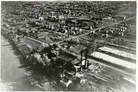
Part of PAHS Archives Collection
Panoramic aerial view taken over River Street, 6th and 7th Avenue West, Prince Albert. Power plant in evidence with smoke stacks
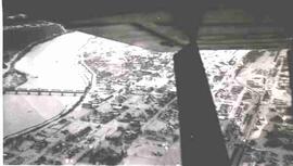
Part of PAHS Archives Collection
Aerial winter view of Prince Albert. Part of airplane, North Saskatchewan River, and railroad bridge are also visible
Aerial view of Quaker Oats building
Part of Saskatoon StarPhoenix fonds
Photograph shows an aerial view of the Quaker Oats building, April 12, 1952.
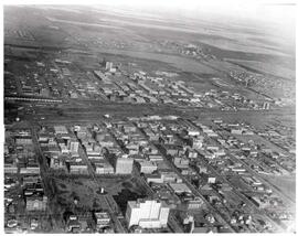
Part of City of Regina fonds
Aerial view of downtown Regina (looking north); Hotel Saskatchewan (Victoria Avenue) to northern City Limits; Metropolitan United Church (Lorne Street) to Broad Street.