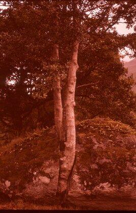
Type section of Eastend formation. Near Gould's Quarry
- WOK 1-112
- Item
- 1954
Part of W.O. Kupsch fonds
Type section of Eastend formation (correlative of Fox Hills in U.S.). Near Gould's Quarry, Eastend, Saskatchewan.
27 results with digital objects Show results with digital objects
Type section of Eastend formation. Near Gould's Quarry
Part of W.O. Kupsch fonds
Type section of Eastend formation (correlative of Fox Hills in U.S.). Near Gould's Quarry, Eastend, Saskatchewan.
Two types of slide shown schematically
Part of W.O. Kupsch fonds
Two types of slide shown schematically. At top three blocks of earth have rotated in clay-water slurry. In the other slide total liquefaction has occurred and water forced out of the clay has formed a pond. The vertical dimension is exaggerated five times. Typical slide has a figure-eight appearance. Material the leaves a hollow at the head region piles up at the foot. The low cliff at the neck is often the bank of a river (Kerr, P.F., 1963, Sci. Amer. Nov., p. 138).
Two samples of quick clay showing contrast
Part of W.O. Kupsch fonds
Two samples of quick clay showing startling contrast. Column of undisturbed clay (left) holds 11 kilograms (24 pounds). It can support 2,100 pounds per square foot surface. Another piece of the same clay pours like a liquid afer being stirred in a beaker. No water was added. Demonstration was made by Carl B. Crawford of the National Research Council of Canada (Kerr, P.F., 1963, Sci. Amer. Nov., p. 134).
Part of W.O. Kupsch fonds
Turbidity currents. Sketch map of 1929 Grand Banks turbidity current. Jacobs et al., 1959, p. 240.
Part of W.O. Kupsch fonds
Turbidity currents. Topographical profile along the path of the 1929 Grand Banks, turbidity current showing cable breaks, cores and velocities of the current. Jacobs et al., 1959, p. 241.
Tunnel-meltwater glacial complex.
Part of W.O. Kupsch fonds
Tunnel-meltwater glacial complex. 1. Moraine plateau. 2. Tunnel valley. a. Mosso basin. b. Saltena valley. 3. Fluvio-glacial valley. 4. Valley terraces, resistant parts of earlier valley bottoms, consisting of metlwater deposits. 5. Dead-ice depressions. c. Salten Langso. d. Bog depression. e. Kettle-holes. 6. Post-glacial erosion valleys, dissecting the moraine plateau. 7. Recent valley bottom. f. Gudena. g. Delta of the River Gudena in the Mosso basin. Source: Atlas of Denmark.
Part of W.O. Kupsch fonds
Tunnel valley. 1. Moraine landscape. 2. Tunnel valley. a. Main valley. b. Lateral valley. c. Lake basins. d. Lagoon of liman type. e. Bay; the sea-transgressed part of the valley. 3. Post-glacial erosion valley. f. River valley eroded in the bottom of the tunnel valley. 4. Isthmus built in spit growth. g. Oldest southerly spit. h. Oldest northerly spit. 5. Barred foreland. Source: Atlas of Denmark.
Triassic to Mid-Lower Cretaceous tectonic map
Part of W.O. Kupsch fonds
Triassic to Mid-Lower Cretaceous tectonic map (Raasch et al., 1961, v. 1, p. 451).
Part of W.O. Kupsch fonds
Triassic facies belts (Raasch et al., 1961, v. 1, p. 389).
Tree stumps along shore of Basin Lake
Part of W.O. Kupsch fonds
Tree stumps along shore of Basin Lake. 28 November, 1962.
Tree splitting schist boulder.
Part of W.O. Kupsch fonds
Tree splitting schist boulder. North end of Lock Lomond, Scotland. Photo W.G.E. Caldwell, August 19, 1961.
Travertine deposits near Izcuchaca
Part of W.O. Kupsch fonds
Travertine deposits near Izcuchaca.
TransAir Canson tilted backward to load back
Part of W.O. Kupsch fonds
TransAir Canson tilted backward to load back, Churchill Manitoba. August 1, 1965.
TransAir Canson CF-IEE, Churchill Manitoba
Part of W.O. Kupsch fonds
TransAir Canson CF-IEE, Churchill Manitoba. August 1, 1965.
Train crossing bridge near monument of David Thompson
Part of W.O. Kupsch fonds
Train crossing bridge near monument of David Thompson, Velva, N.D. May, 1962.