- WOK 1-17
- Item
- [1952-1954]
Parte de W.O. Kupsch fonds
Map of the Netherlands without dikes. Shows the potential area of flooding by sea water and fresh water. Map copied from a book.
21 resultados com objetos digitais Mostrar resultados com objetos digitais
Parte de W.O. Kupsch fonds
Map of the Netherlands without dikes. Shows the potential area of flooding by sea water and fresh water. Map copied from a book.
Parte de MJ General Photograph Collection
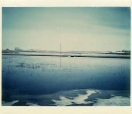
Flood waters of Thunder Creek near house on 9th Avenue NW in Moose Jaw, showing reflection of house and buildings
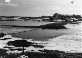
Flooding of Thunder Creek at Boharm
Parte de MJ General Photograph Collection
Aerial view of flooding of Thunder Creek at Boharm, Saskatchewan. Flooded land next to railway tracks in foreground; Saskatchewan Pool elevator and unidentified elevator in background
Heavy spring run-off goes over the road at the Trapp family water conservation dam.
View from north of Rosetown looking south. Fields are flooded. Elevators and a farm service centre can be seen in the distance.
Extent of flooding in southwestern Netherlands
Parte de W.O. Kupsch fonds
Map of southwestern Netherlands the extent of flooding. Map copied from a book.
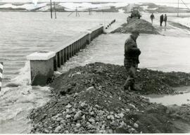
Eagle Creek floods over Highway 4
Parte de Frank Glass Photograph Collection
Eagle Creek has flooded highway 4 and a four man road crew is working on it.
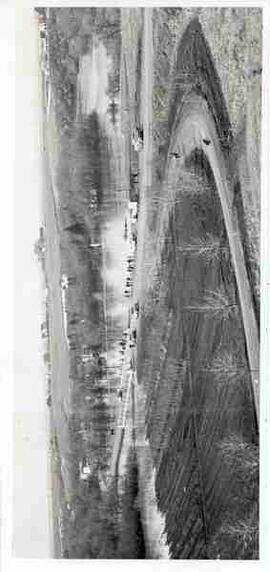
Flooding along Moose Jaw River
Parte de MJ General Photograph Collection
Elevated view of bridge and Moose Jaw River with cars and people along side of road
Parte de MJ General Photograph Collection
Aerial view of flooding of Thunder Creek in Moose Jaw
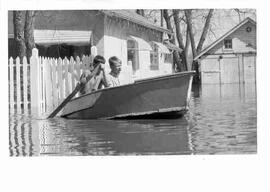
Parte de MJ General Photograph Collection
Two boys paddle a boat in a residential area of Moose Jaw during flooding of Moose Jaw River
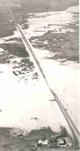
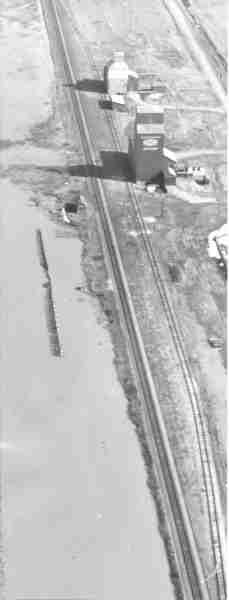
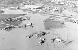
Flooding of Thunder Creek at Boharm
Parte de MJ General Photograph Collection
Aerial view of flooding of Thunder Creek on old Highway 1 at Boharm, Saskatchewan. Farmyard in foreground; railway tracks cut through centre of image
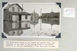
The Sutherland house at the corner of Laurier Ave.
Parte de Howard Jackson Collection
The Sutherland house at the corner of Laurier Ave. and Broadway at the time of the spring flood in the 1920s.
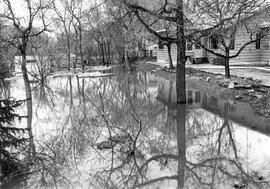
Parte de MJ General Photograph Collection
Flooding in residential area in Moose Jaw, with reflection of house and trees in flood water
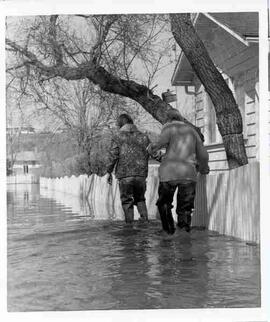
Parte de MJ General Photograph Collection
Two people with backs to camera walk in flood waters of Moose Jaw River in residential area of Moose Jaw
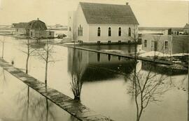
Zealandia during a spring flood. The United Church is front and centre. The water is nearly running over the wooden sidewalks in places.