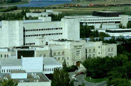
Saskatoon, Saskatchewan, Aerial View
- JGD/MG01/XVII/JGD 4943
- Item
- [1980s]
Part of John G. Diefenbaker fonds
The Right Honourable John G. Diefenbaker Centre taken from the top of the Education Building. Down town core of Saskatoon in background.
458 results with digital objects Show results with digital objects
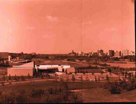
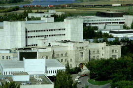
Saskatoon, Saskatchewan, Aerial View
Part of John G. Diefenbaker fonds
The Right Honourable John G. Diefenbaker Centre taken from the top of the Education Building. Down town core of Saskatoon in background.
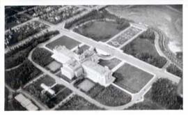
Saskatchewan Legislative Grounds and Wascana Lake
Part of City of Regina fonds
Aerial view of the Saskatchewan Legislative Grounds and Wascana Lake; note that Wascana Lake is drained/empty.
Hall, A.C.V.
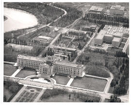
Saskatchewan Legislative Building and Grounds
Aerial view of the Saskatchewan Legislative Building and Grounds, including part of Wascana Lake and part of downtown Regina.
Saskatchewan Photo Services
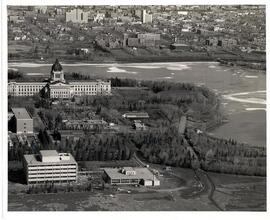
Saskatchewan Legislative Building and Grounds
Aerial view of the Saskatchewan Legislative Building and surrounding grounds including part of Wascana Lake in Regina, Saskatchewan
Saskatchewan Photo Services
Rubber boats dropped by plane in rescue operations
Part of W.O. Kupsch fonds
Aerial photograph of rubber boats being used to rescue people during flood.
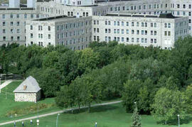
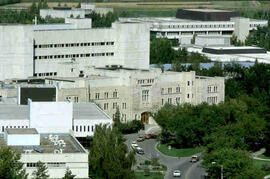
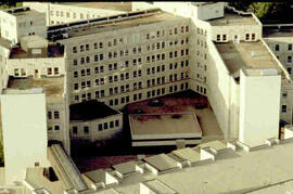
Royal University Hospital and Little Stone Schoolhouse
Part of Educational Media Access and Production (EMAP) fonds
Aerial views of campus
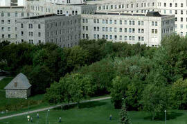
Royal University Hospital and Little Stone Schoolhouse
Part of Educational Media Access and Production (EMAP) fonds
Aerial views of campus
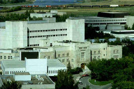
Part of Educational Media Access and Production (EMAP) fonds
Aerial views of campus
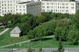
Part of Educational Media Access and Production (EMAP) fonds
Aerial views of campus
Part of Educational Media Access and Production (EMAP) fonds
Aerial views of campus
Part of Educational Media Access and Production (EMAP) fonds
Aerial views of campus
Part of Educational Media Access and Production (EMAP) fonds
Aerial views of campus
Part of Educational Media Access and Production (EMAP) fonds
Aerial views of campus

Shows the layout of Rosetown from Highway 4 N to 6th Ave. and Main Street to 9th Ave.

Looking northeast. Main Street, Highway 4, and 6th Avenue are marked.