Aerial view of minor end moraines
- WOK 5-40
- Item
- [1947-56]
Part of W.O. Kupsch fonds
Aerial view of minor end moraines. Location: sec. 34, T. 5, R. 20, W. 3, Sask.
37939 results with digital objects Show results with digital objects
Aerial view of minor end moraines
Part of W.O. Kupsch fonds
Aerial view of minor end moraines. Location: sec. 34, T. 5, R. 20, W. 3, Sask.
Part of Saskatoon StarPhoenix fonds
Photograph shows an aerial view of Montreal Lake, August - September 1949.
Part of MJ General Photograph Collection
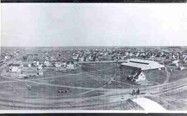
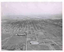
Aerial view of northwest area of Moose Jaw, Saskatchewan
Part of MJ General Photograph Collection
View of Moose Jaw looking southeast from Central Collegiate, showing curling rink and houses
Aerial view of Moose Jaw, Saskatchewan
Part of MJ General Photograph Collection
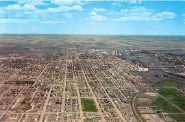
Aerial view of Moose Jaw, Saskatchewan from the west
Aerial view of Moose Jaw, Saskatchewan
Part of MJ General Photograph Collection
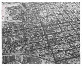
Aerial view of central Moose Jaw looking north
Aerial view of Moose Jaw, Saskatchewan
Part of MJ General Photograph Collection
Aerial view looking northwest over Canadian Pacific Railway yards with the CPR Roundhouse visible

Aerial view of Moose Jaw, Saskatchewan
Part of MJ General Photograph Collection
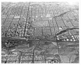
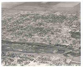
Aerial view of Moose Jaw, Saskatchewan, south of downtown area; Crescent Park is also visible
Aerial view of Moose Jaw, Saskatchewan
Part of MJ General Photograph Collection
Aerial view of Moose Jaw, Saskatchewan from the Rosedale Cemetery looking east; the Drive-in and Caribou Heights Athletic Field are visible as well.
Aerial view of Moose Jaw, Saskatchewan
Part of MJ General Photograph Collection
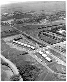
Aerial view of new houses in the River Park area of southeast Moose Jaw, Saskatchewan

Aerial view of Moose Jaw, Saskatchewan
Part of MJ General Photograph Collection
Aerial view southward down Main Street towards Canadian Pacific Railway station; Civic Centre seen in foreground

Aerial view of Moose Jaw, Saskatchewan, ca. 1930
Part of MJ General Photograph Collection
Aerial view of Moose Jaw, showing south hill area and many prairie trails leading to city.
Royal Canadian Air Force (R.C.A.F.)
Aerial view of moraine showing "doughnut" pattern
Part of W.O. Kupsch fonds
Aerial photograph of moraine with "doughnut" pattern. Note "doughnut" in the centre of sec. 33. Sec. 36, T. 6, R. 2, W. 2.
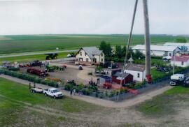
Aerial view of Museum and grounds
Aerial view shows the Tea House, Fire Hall, School, Church, Blacksmith Shop, tractors, and main buildings. Photographed from a SaskTel balloon in 2008.
Part of Saskatoon StarPhoenix fonds
Photograph shows an aerial view of Nipawin, December 15, 1950.