- WOK 4-115
- Stuk
- [1948-1957]
Part of W.O. Kupsch fonds
Map shapes of end moraines (Gripp, 1955, p.42).
20 results with digital objects Show results with digital objects
Part of W.O. Kupsch fonds
Map shapes of end moraines (Gripp, 1955, p.42).
Geomorphology and structure of island of Ruegen, Germany
Part of W.O. Kupsch fonds
Geomorphology and structure of island of Ruegen, Germany (Brinkman, 1953, p. 237).
Direction of ice movement during end moraine formation - Ruegen, Germany
Part of W.O. Kupsch fonds
Direction of ice movement during the formation of thrust end moraines on the island of Ruegen, Germany (Brinkman, 1953, p. 238).
Swell and swale pattern of Mankato lobe in Iowa
Part of W.O. Kupsch fonds
Swell and swale pattern of Mankato lobe in Iowa (Gwynne, 1942, fig. 1).
Circular pattern of minor end moraines
Part of W.O. Kupsch fonds
Circular pattern of minor end moraines (Gwynne, 1951, fig. 2).
Profiles across swells and swales
Part of W.O. Kupsch fonds
Profiles across swells and swales (Gwynne, 1951, fig. 3).
Diagrams illustrating origin of kames
Part of W.O. Kupsch fonds
Diagrams illustrating origin of kames (Emmons et al., 1955, p. 260).
Diagrammatic cross section of a simple delta
Part of W.O. Kupsch fonds
Diagrammatic cross section of a simple delta.
Terminology of features along a shoreline
Part of W.O. Kupsch fonds
Terminology of features along a shoreline (Leet and Judson, 1954, p. 261).
Map showing extent of present permafrost
Part of W.O. Kupsch fonds
Map showing extent of present permafrost (Black, 1954, fig. 1).
Preglacial Neidpath channel, gentle slopes, wide valley
Part of W.O. Kupsch fonds
Preglacial Neidpath channel, gentle slopes, wide valley.
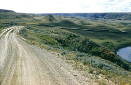
Slumping in valley of Swift Current Creek
Part of W.O. Kupsch fonds
Slumping in valley of Swift Current Creek in western Saskatchewan
Zonder titel
Slumping in valley of Swift Current Creek
Part of W.O. Kupsch fonds
Slumping in valley of Swift Current Creek.
Parabolic blow-out dune - Great Sand Hills area
Part of W.O. Kupsch fonds
Inside of parabolic blow-out dune, Great Sand Hills area in sec. 29, T. 16, R. 21, W. 3. Notice the gentle depositional slope along central axis to left, steep erosional slopes on side of U.
View in direction of wind into blow-out dune - Great Sand Hills
Part of W.O. Kupsch fonds
A view in the direction of the wind into blow-out dune, Great Sand Hills area in sec. 29, T. 16, R. 21, W. 3.