- RG2024-2006-086-491
- Item
- unknown
Part of Educational Media Access and Production (EMAP) fonds
Aerial views of campus
Part of Educational Media Access and Production (EMAP) fonds
Aerial views of campus
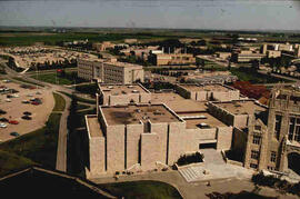
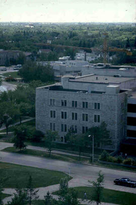
Thorvaldson Building - Aerial View
New addition to the Thorvaldson (Chemistry) Building.
Bio/Historical Note: The Chemistry Building was enlarged with an addition and was renamed in honour of Dr. Thorbergur Thorvaldson, professor and dean of Chemistry from 1919-1959. The Thorvaldson Building opened on 6 June 1966. Architect John B. Parkin’s modern design continued with exterior stone cladding. The near windowless, stone three-storey addition provided classrooms, undergraduate and research laboratories, offices, a library and service facilities.
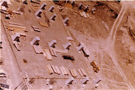
Thorvaldson Building - Construction
Aerial view of foundations of Thorvaldson Addition being laid.
Bio/Historical Note: The Chemistry Building was enlarged with an addition and was renamed in honour of Dr. Thorbergur Thorvaldson, professor and dean of Chemistry from 1919-1959. The Thorvaldson Building opened on 6 June 1966. Architect John B. Parkin’s modern design continued with exterior stone cladding. The near windowless, stone three-storey addition provided classrooms, undergraduate and research laboratories, offices, a library and service facilities.
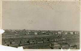
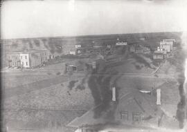
Town of Biggar, Saskatchewan in the 1920s
Part of Biggar Photograph Collection
Aerial view of buildings and train cars in Biggar, Saskatchewan.
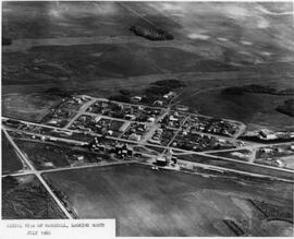
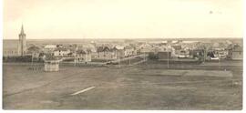
Town of Marshall, Saskatchewan
Aerial view of Marshall, Saskatchewan, looking north
Part of MJ General Photograph Collection
Aerial view of Tuxford, Saskatchewan ‘in the early years’.
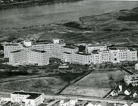
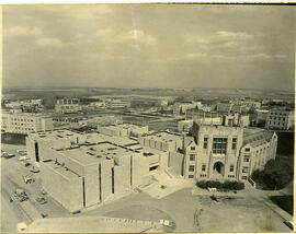
Looking north at University Hospital and Medical Building. College Drive in the foreground.
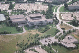
University of Saskatchewan College of Education Building
Aerial view of the exterior of the College of Education building and Diefenbaker Centre.
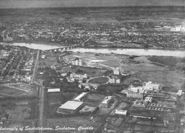
University of Saskatchewan, Saskatoon, Canada
Aerial view of the University of Saskatchewan campus in Saskatoon, SK, looking west.
Royal Canadian Air Force (R.C.A.F.)
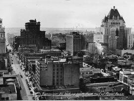
Aerial view of Vancouver, BC looking south from roof of the Royal Bank Building
Part of City of Regina fonds
Aerial/bird's-eye view of Victoria Park looking southeast; band shell & cricket pitch in foreground.
Part of City of Regina fonds
Aerial/birds'-eye view of Victoria Park from the roof of the Regina Library looking east; note: fountain in centre of park has been replaced by the Cenotaph.
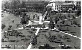
Victoria Park with Cenotaph, Regina
Part of City of Regina fonds
Aerial/birds' eye view of Victoria Park and Cenotaph facing towards 12th Avenue and Cornwall Street.
Part of Educational Media Access and Production (EMAP) fonds
Aerial views of campus

"View of Prince Rupert Water Front"
An aerial view of Prince Rupert, BC.