
‘General View of Lloydminster, looking South East’
- BCHCC 1177
- Item
- 1909
‘General View of Lloydminster, looking South East’ in 1909.
408 results with digital objects Show results with digital objects
‘General View of Lloydminster, looking South East’
‘General View of Lloydminster, looking South East’ in 1909.

Part of City of Regina fonds
1800 block Scarth Street looking south from 11th Avenue along the west side of Scarth Street.
Part of Educational Media Access and Production (EMAP) fonds
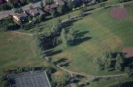
Aerial of Saskatoon Soccer Field, Baseball Diamond and Tennis Court with residences in background.
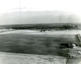
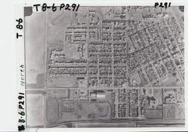
Aerial photo of Indian Head Collegiate and former airport
Part of Town Collection
Photograph taken from an airplane looking northeast over the Indian Head Collegiate (high school) to the former airport - now Indian Head Golf Course.
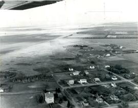
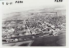
Aerial photo of Indian Head from the north
Part of Town Collection
Photograph taken from an airplane looking south toward Indian Head. The Experimental Farm barn and office building are on the far left of the photograph.
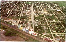
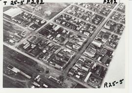
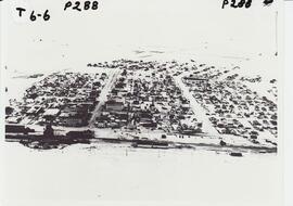
Aerial photo of Indian Head from the southeast
Part of Town Collection
Photograph taken from an airplane looking northwest with the railway in the foreground and looking directly up Grand Avenue
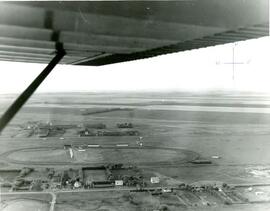
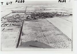
Aerial photo of Indian Head horse race track and former airport
Part of Town Collection
Photograph taken from an airplane looking north over the fairgrounds/horse race track to the former airport - now Indian Head Golf Course.

Aerial photo of Uranium City, Saskatchewan
Part of R.M. Bone fonds
Aerial view of Uranium City, Saskatchewan.
Hunting Survey Corporation Limited Toronto, Canada
Aerial photograph: A 12575-249
Part of W.O. Kupsch fonds
Aerial photograph: A 12575-249. Same as slide 120, stereo pair.
An aerial photo of Rosetown taken directly overhead with the southwest corner of town out of view.
An aerial view of Rosetown from the end of Main Street and the southwest corner of town.
An aerial view of Rosetown from the south looking north across the rooftops and countryside.
An aerial view of Rosetown taken at a distance from the south looking north, the entire town may be seen in a general layout.
An aerial photo of Rosetown taken in winter taken from the south looking north.
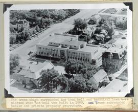
Aerial view and grounds the Yorkton Town hall
Part of Howard Jackson Collection
The trees and lawn which surrounded the Town hall