- CORA-B-792
- Stuk
- 1931
Part of City of Regina fonds
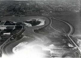
An empty Wascana Lake before the 1931 deepening.

Part of City of Regina fonds
An empty Wascana Lake before the 1931 deepening.
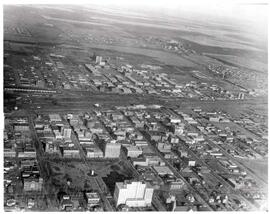
Aerial view of Regina looking northeast
Part of City of Regina fonds
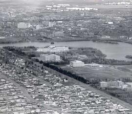
Aerial view looking northeast over the city. The Legislative Buildings, Wascana Lake and Campion College are seen in foreground. From Thornton Avenue to outer city limits (north), Rae Street to east edge of Wascana Park.
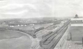
Aerial view of the CP rail-yards and warehouse districts
Part of City of Regina fonds
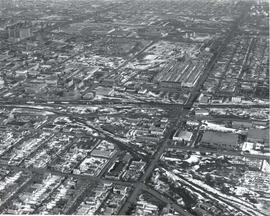
Rail-yards and warehouse district from the air. From Broad Street to Broder Street, Arcola Avenue to outer city limits (north).
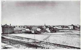
Birds'-Eye view of the North-West Mounted Police (NWMP) yard
Part of City of Regina fonds
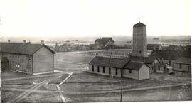
Birds'-Eye view of the North-West Mounted Police (NWMP) yard and buildings
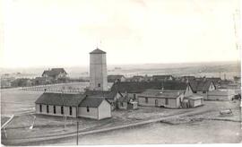
North West Mounted Police (NWMP) Barracks
Part of City of Regina fonds
North West Mounted Police barracks, birds'-eye view
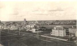
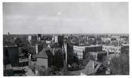
Bird's eye view of Regina downtown core
Part of City of Regina fonds
Birds'-eye view of Regina's downtown core area. View is from Victoria Avenue and Smith Street. Old Laird house is in the foreground. Knox Presbyterian Church is visible.
Bird's eye view of Regina CPR yards
Part of City of Regina fonds
Bird's eye view of early Regina downtown core. Canadian Pacific Railway Yards.
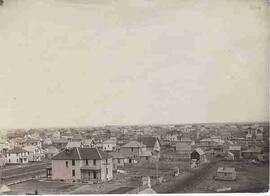
Bird's eye view of Regina's downtown core
Part of City of Regina fonds
Bird's eye view of Regina downtown core in the early 1900s.
Part of City of Regina fonds
Aerial view of downtown Regina (looking north); Hotel Saskatchewan (Victoria Avenue) to northern City Limits; Metropolitan United Church (Lorne Street) to Broad Street.
Part of City of Regina fonds
Bird's eye view of Regina's downtown core
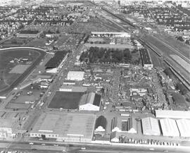
Exhibition Grounds with midway
Part of City of Regina fonds
Aerial view of Exhibition Grounds looking east from Regina Avenue. Midway and buildings in foreground, racetrack to the left.
Part of City of Regina fonds
Birds' Eye View of Regina. The view of the south western downtown area is taken from the top of the Canada Life Building. The Knox Metropolitan Church is visible.
Part of City of Regina fonds
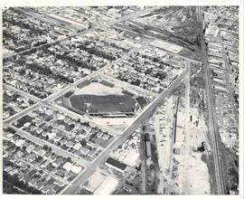
Aerial photograph of Taylor Field (home of the Saskatchewan Roughriders) and surrounding neighbourhood.

Part of City of Regina fonds
1800 block Scarth Street looking south from 11th Avenue along the west side of Scarth Street.
Part of City of Regina fonds
Aerial/birds'-eye view of Victoria Park from the roof of the Regina Library looking east; note: fountain in centre of park has been replaced by the Cenotaph.