Aerial View of The Rural Municipality of Biggar #347
- 09.710.36F
- Item
- ca. 1960
Parte de Biggar Photograph Collection
An aerial view of TP 36 RG 13 in the Rural Municipality of Biggar # 347
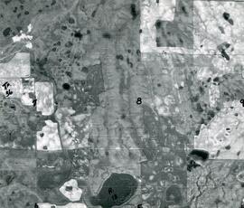
Aerial View of The Rural Municipality of Biggar #347
Parte de Biggar Photograph Collection
An aerial view of TP 36 RG 13 in the Rural Municipality of Biggar # 347
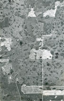
Aerial View of The Rural Municipality of Biggar #347
Parte de Biggar Photograph Collection
An aerial view of TP 37 RG 13 in the Rural Municipality of Biggar # 347

Bird's Eye View of Indian Head, looking North
Parte de Town Collection
Coloured postcard of Indian head taken from the top of a grain elevator. Flour mill building is to the right.
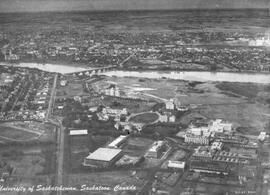
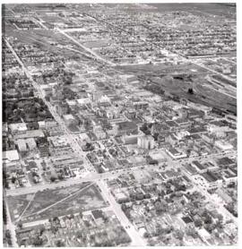
University of Saskatchewan, Saskatoon, Canada
Aerial view of the University of Saskatchewan campus in Saskatoon, SK, looking west.
Sem título

‘General View of Lloydminster, looking South East’
‘General View of Lloydminster, looking South East’ in 1909.
Parte de LRA Photograph Collection
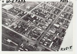
Aerial view of Melfort, Saskatchewan
Parte de Melfort General Photo collection
Aerial view of Melfort Saskatchewan
Sem título
Parte de Frank Glass Photograph Collection
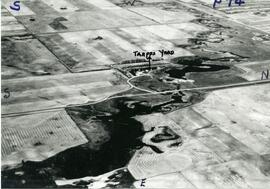
An aerial view of the Trapp Family Dam. A Ducks Unlimited conservation project.
Parte de Frank Glass Photograph Collection
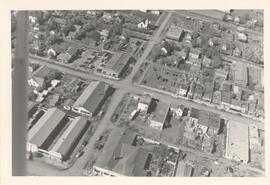
An aerial view of Rosetown from the end of Main Street and the southwest corner of town.

Rail yard - Prince Albert, Saskatchewan
Parte de Hans Dommasch fonds
Grain elevators, railway boxcars and buildings are seen covered in snow in the railyard of Prince Albert, Saskatchewan.
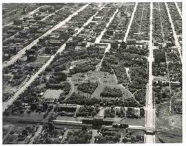
Sem título
Parte de City of Regina fonds
Regina's downtown from the air. Victoria Park to left middle, gingerbread City Hall to middle, roundhouse to right middle. The area from 12th Avenue to South Railway Street, Pasqua Street to Halifax Street is seen.
Aerial view of Crescent Park in Moose Jaw, Saskatchewan
Parte de MJ General Photograph Collection
Aerial view of Crescent Park and surrounding area in Moose Jaw, Saskatchewan
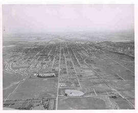
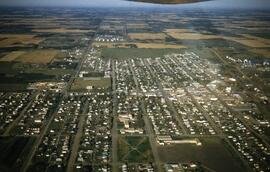
Aerial view of Moose Jaw, Saskatchewan
Parte de MJ General Photograph Collection
Aerial view of Moose Jaw, Saskatchewan from the Rosedale Cemetery looking east; the Drive-in and Caribou Heights Athletic Field are visible as well.
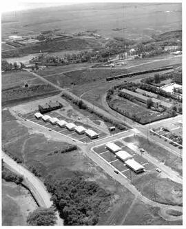
Aerial view of Moose Jaw, Saskatchewan
Parte de MJ General Photograph Collection
Aerial view of new houses in the River Park area of southeast Moose Jaw, Saskatchewan

Aerial view of Moose Jaw, Saskatchewan
Parte de MJ General Photograph Collection
Aerial view southward down Main Street towards Canadian Pacific Railway station; Civic Centre seen in foreground