Crude oil production and refining after Agricola
- WOK 1-6
- Item
- [1952-1954]
Parte deW.O. Kupsch fonds
Illustration of oil production and refining after Agricola, 1550. Illustration copied from book.
21 resultados con objetos digitales Muestra los resultados con objetos digitales
Crude oil production and refining after Agricola
Parte deW.O. Kupsch fonds
Illustration of oil production and refining after Agricola, 1550. Illustration copied from book.
Parte deW.O. Kupsch fonds
Distillation apparatus. Diagram copied from a book.
Smelting bitumen from bituminous rocks after Agricola, 1550
Parte deW.O. Kupsch fonds
Illustration of smelting bitumen from bituminous rocks after Agricola, 1550. Illustration copied from book.
Map of the Netherlands during Roman times
Parte deW.O. Kupsch fonds
Map of the Netherlands during Roman times showing land area and river channels.
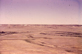
Meandering River in Frenchman Valley near Watson's Bridge
Parte deW.O. Kupsch fonds
Meandering River in Frenchman Valley near Watson's Bridge looking south; one can also see the prominent white band: Whitebud formation (Upper Cretaceous)
Sin título
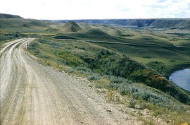
Alluvial fan from tributary into Qu'Appelle Valley - Katepwa, Saskatchewan
Parte deW.O. Kupsch fonds
Alluvial fan from tributary into Qu'Appelle Valley near Katepwa, Saskatchewan.
Sin título
Slumping in valley of Swift Current Creek
Parte deW.O. Kupsch fonds
Slumping in valley of Swift Current Creek in western Saskatchewan
Sin título
Map of the Netherlands, 16th century
Parte deW.O. Kupsch fonds
Map of the Netherlands during the 16th century. Shows the land area and drainage channels.
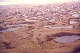
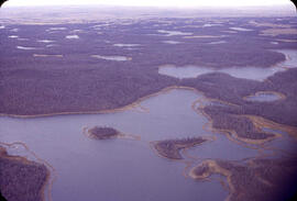
Aerial view of dead ice moraine with knob and kettle topography
Parte deW.O. Kupsch fonds
Aerial view of dead ice moraine with knob and kettle topography; Western part of Moose Mountain, Saskatchewan.
Sin título
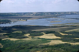
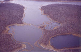
Aerial view of dead ice moraine - effects of lowered water level
Parte deW.O. Kupsch fonds
Aerial view of dead ice moraine showing the effects of lowered water level in ponds; Western part of Moose Mountain, Saskatchewan
Sin título
Aerial view of dead ice moraine - effects of lowered water level
Parte deW.O. Kupsch fonds
Aerial view of dead ice moraine showing the effects of lowered water level in ponds; Western part of Moose Mountain, Saskatchewan.
Sin título

Slumping in valley of Swift Current Creek
Parte deW.O. Kupsch fonds
Slumping in valley of Swift Current Creek in western Saskatchewan
Sin título
Aerial view of settlement, Inuvik, N.W.T.
Parte deW.O. Kupsch fonds
Citation reads: "Aerial view of settlement, Inuvik, N.W.T. August 22, 1965."
Father Henry, Chesterfield Inlet, N.W.T.
Parte deW.O. Kupsch fonds
Father Henry, Chesterfield Inlet, N.W.T. August 3, 1965.
Parte deW.O. Kupsch fonds
Citation reads: "General view of mining camp, Mary River, N.W.T. August 15, 1965."