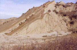
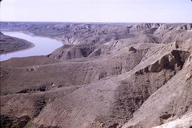
Ice-shove deformation in the Dirt Hills area of Saskatchewan
- WOK 5-63
- Item
- 1956
Parte deW.O. Kupsch fonds
Ice-shove deformation (Tilted Eastend strata) in the Dirt Hills area of Saskatchewan.
Sin título
Ice-shove deformation in the Dirt Hills area of Saskatchewan
Parte deW.O. Kupsch fonds
Ice-shove deformation (Tilted Eastend strata) in the Dirt Hills area of Saskatchewan.
Sin título

Slumping in valley of Swift Current Creek
Parte deW.O. Kupsch fonds
Slumping in valley of Swift Current Creek in western Saskatchewan
Sin título
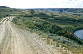
Slumping in valley of Swift Current Creek
Parte deW.O. Kupsch fonds
Slumping in valley of Swift Current Creek in western Saskatchewan
Sin título
Parte deW.O. Kupsch fonds
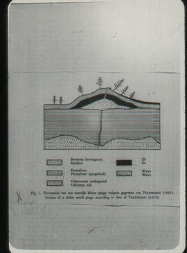
Section through a small pingo (Maarleveld and Van den Toorn, 1955, fig. 1).
Parte deW.O. Kupsch fonds
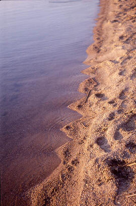
Small beach cusps along shore of Dore Lake. May 22, 1976.
Ice-contact gravel ridge - northeast of Lampman, Saskatchewan
Parte deW.O. Kupsch fonds
Ice-contact gravel ridge (minor end moraine?) - northeast of Lampman, Saskatchewan.
Sin título
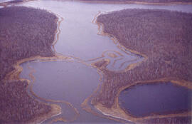
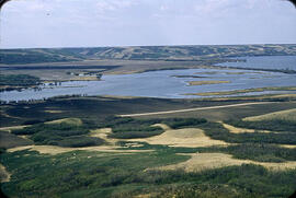
Aerial view of dead ice moraine - effects of lowered water level
Parte deW.O. Kupsch fonds
Aerial view of dead ice moraine showing the effects of lowered water level in ponds; Western part of Moose Mountain, Saskatchewan.
Sin título
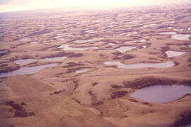
Aerial view of dead ice moraine - effects of lowered water level
Parte deW.O. Kupsch fonds
Aerial view of dead ice moraine showing the effects of lowered water level in ponds; Western part of Moose Mountain, Saskatchewan
Sin título
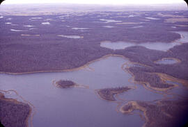
Aerial view of dead ice moraine with knob and kettle topography
Parte deW.O. Kupsch fonds
Aerial view of dead ice moraine with knob and kettle topography; Western part of Moose Mountain, Saskatchewan.
Sin título
Alluvial fan from tributary into Qu'Appelle Valley - Katepwa, Saskatchewan
Parte deW.O. Kupsch fonds
Alluvial fan from tributary into Qu'Appelle Valley near Katepwa, Saskatchewan.
Sin título
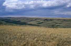
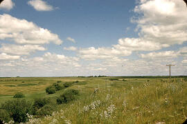
Terraces along the Arm River Channel near Aylesbury, Saskatchewan
Parte deW.O. Kupsch fonds
View of the terraces along the Arm River Channel near Aylesbury, Saskatchewan.
Sin título
Parte deW.O. Kupsch fonds
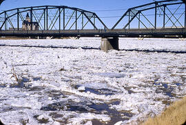
Ice jamming during break up. Notice the branches, etc. on ice.
South Saskatchewan River near Prelate Ferry
Parte deW.O. Kupsch fonds
South Saskatchewan River and Pleistocene section near Prelate Ferry, Saskatchewan.
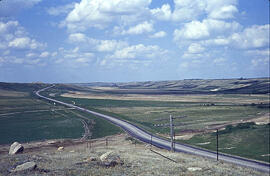
Highway 11 at Blackstrap Coulee
Parte deW.O. Kupsch fonds
Highway 11 crossing Blackstrap Coulee near Dundurn, Saskatchewan. Note lag concentrate of large boulders in foregroundon eroded valley slope; dam in background, reservoir not yet filled. June 1967.
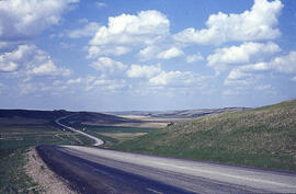
Parte deW.O. Kupsch fonds
Blackstrap Coulee near Dundurn, Saskatchewan. June 1967.