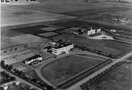
Aerial view of the hospital and nurses residence
- FGPC-HE-P293
- Pièce
- [ca. 1930]
Fait partie de Frank Glass Photograph Collection
An aerial view of the Rosetown Hospital and adjacent nurses residence with St. Joseph's convent beside them.
750 résultats directement liés Exclure les termes spécifiques
Aerial view of the hospital and nurses residence
Fait partie de Frank Glass Photograph Collection
An aerial view of the Rosetown Hospital and adjacent nurses residence with St. Joseph's convent beside them.
Fait partie de Frank Glass Photograph Collection
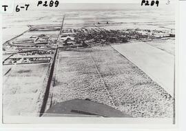
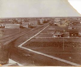
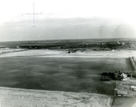
An aerial view of Rosetown from the south looking north across the rooftops and countryside.
Fait partie de Frank Glass Photograph Collection
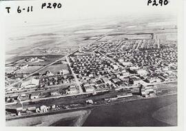
An aerial view of Rosetown taken at a distance from the south looking north, the entire town may be seen in a general layout.
Fait partie de MJ General Photograph Collection
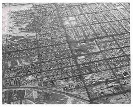
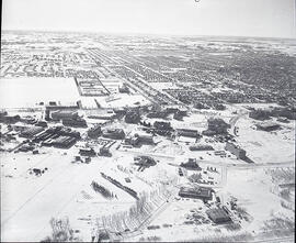
Aerial view of northwest area of Moose Jaw, Saskatchewan
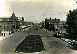
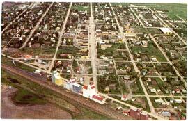
Main Street from C.P.R. Depot in Moose Jaw, Sask.
Fait partie de Rice's Studio collection
Image of Main Street from the Canadian Pacific Railway (CPR) depot in Moose Jaw, Saskatchewan; includes view of Manitoba Street and the Maple Leaf Hotel.
Sans titre
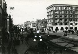
Main Street looking north, Moose Jaw, Sask.
Fait partie de Rice's Studio collection
Image of Main Street looking north in Moose Jaw, SK with pedestrians walking along the street. Automobiles are parked along the street and a streetcar is travelling down the street. The Walter Scott building can be seen at the corner of Main Street and High Street.
Sans titre
Fait partie de MJ General Photograph Collection
Aerial view of Kalium Chemicals Ltd. potash plant at Belle Plaine, Saskatchewan
Fait partie de Town Collection
Looking over Indian Head, you can see the Gordon Hotel as well the Methodist Church and, in the distance, the original Presbyterian Church.
Aerial photo of Indian Head Collegiate and former airport
Fait partie de Town Collection
Photograph taken from an airplane looking northeast over the Indian Head Collegiate (high school) to the former airport - now Indian Head Golf Course.
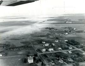
Aerial photo of Indian Head from the north
Fait partie de Town Collection
Photograph taken from an airplane looking south toward Indian Head. The Experimental Farm barn and office building are on the far left of the photograph.
Aerial photo of Indian Head from the southeast
Fait partie de Town Collection
Photograph taken from an airplane looking northwest with the railway in the foreground and looking directly up Grand Avenue
Fait partie de Institute for Northern Studies fonds
A closeup of a street in Prince Rupert, BC.
Fait partie de University of Saskatchewan Photograph Collection
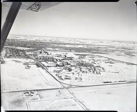
Winter view looking north across campus.
Fait partie de University of Saskatchewan Photograph Collection
Winter view looking south across campus.
Fait partie de University of Saskatchewan Photograph Collection
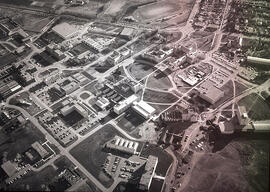
View facing south with Arts and Chemistry buildings and the Bowl in foreground. Also visible is construction of Marquis Hall and the St. Thomas More College addition.