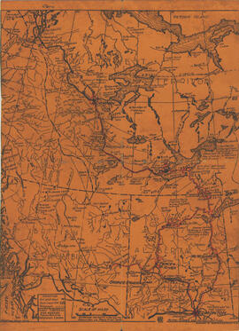
Alberta & Artic Transportation Company Limited Map Adicionar à área de transferência INS-768 Item Unknown Parte de Institute for Northern Studies fonds A printed map of Alberta, British Columbia and the Northwest Territorries, with the Mackenzie and Peace Rivers outlined. (Not a photograph)
The Netherlands without dikes Adicionar à área de transferência WOK 1-17 Item [1952-1954] Parte de W.O. Kupsch fonds Map of the Netherlands without dikes. Shows the potential area of flooding by sea water and fresh water. Map copied from a book.
Map of the Netherlands, 16th century Adicionar à área de transferência WOK 1-20 Item [1952-1954] Parte de W.O. Kupsch fonds Map of the Netherlands during the 16th century. Shows the land area and drainage channels.
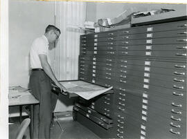
J.C. McConnell Adicionar à área de transferência A-4459 Item Aug. 1965 Parte de University of Saskatchewan Photograph Collection J.C. McConnell, instructor in Geography and Librarian for the Land Use Mapping Project, checks the accuracy of maps made from air photo interpretations.
Billboard map of Tuktoyaktuk Adicionar à área de transferência WOK 20-25 Item 1965 Parte de W.O. Kupsch fonds Citation reads: "Billboard map of settlement, Tuktoyaktuk, N.W.T. August 21, 1965."