Bison skull in alluvium of South Saskathcewan River
- WOK 5-65
- Item
- 1956
Part of W.O. Kupsch fonds
Bison skull in alluvium of South Saskathcewan River near Outlook, Sask.
27 results with digital objects Show results with digital objects
Bison skull in alluvium of South Saskathcewan River
Part of W.O. Kupsch fonds
Bison skull in alluvium of South Saskathcewan River near Outlook, Sask.
Bitumen jointed masonry of temple of Ur of the Chaldees
Part of W.O. Kupsch fonds
Photograph of bitumen jointed masonry of the temple of Ur of the Chaldees. Photograph copied from a book.
Bituminous sand in till, Fleury Point, Saskatchewan
Part of W.O. Kupsch fonds
Bituminous sand in till, Fleury Point, Saskatchewan.
Bjorne Oeninsula, Ellesmere ground view
Part of W.O. Kupsch fonds
Bjorne Peninsula, Ellesmere ground view, detail. Close up to show Quaternary (?) gravel lying unconformably on Triassic Heiberg sands at station 63K192. Aug 12, 1963.
Bjorne Oeninsula, Ellesmere ground view
Part of W.O. Kupsch fonds
Bjorne Peninsula, Ellesmere ground view. Looking east-northeast from station 63K192 to show exposure of Triassic Heiberg sands and coals in gullies dissected into upland along north coast of Bjorne Peninsula. Aug 12, 1963.
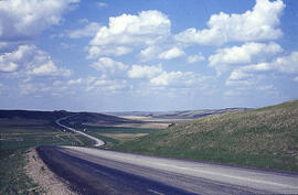
Part of W.O. Kupsch fonds
Blackstrap Coulee near Dundurn, Saskatchewan. June 1967.
Part of W.O. Kupsch fonds
Blake plateau, which intervenes between the continental shelf and the outer escarpment of the continental slope. Note that the axis of the Gulf Stream hugs the continental shelf in its average position. Shepard, 1960, p. 115.
Blind, white, water horse in Pucallpa street
Part of W.O. Kupsch fonds
Blind, white, water horse in Pucallpa street with water in the ditch.
Block diagram of a wave-cut cliff and stack
Part of W.O. Kupsch fonds
Block diagram of a wave-cut cliff and stack. The base of the cliff is eroded by storm waves but is not reached by smaller waves in calm weather. Zumberge, 1958, p. 198.
Block diagram of breaking wave showing pattern of wave movement
Part of W.O. Kupsch fonds
Waves. Block diagram of breaking wave showing pattern of wave movement. Note the general condition of eddy development which leads to turbulence. Dapples, 1959, p. 257.
Block diagram showing isoseismal lines of an earthquake
Part of W.O. Kupsch fonds
Earthquake. Block diagram showing isoseismal lines and their relation to the epicentre and to the wave paths radiating from the focus of an earthquake. Holmes, 1953, p. 364.
Block diagram showing possible development of Missouri Coteau
Part of W.O. Kupsch fonds
Block diagram showing possible development of Missouri Coteau.
Block diagram showing stages of erosion of a mountain in the Basin and Range provinces
Part of W.O. Kupsch fonds
Block diagram showing stages of erosion of a mountain in the Basin and Range province. An initial fault-block form is assumed in stage A, but successing stages might have developped from any initial tectonic form. (A) Fan-free and Fan-based, (B) Fan-dented, (C) Fan-bayed, (D) Fan-frayed, (E) Fan-wrapped, (F) Pan-fan. King 1959, p. 155.
Block diagrams showing changes due to valley glaciation
Part of W.O. Kupsch fonds
Block diagrams showing changes due to valley glaciation. (A) Unglaciated mature topography. (B) A system of valley glaciers occupies the former stream valleys and causes deep erosion. Frost action causes weathering of unglaciated slopes and provides a source of debris for lateral moraines. (C) Climatic change causes melting and disappearance of glaciers, leaving behind tell-tale topography which includes hanging valleys. U-shaped valleys, lakes, end moraines, and rugged peaks.