- 68-113
- Item
- 1903
Part of MJ General Photograph Collection
Dam and boathouse on Moose Jaw River near Manitoba Street East
16 results with digital objects Show results with digital objects
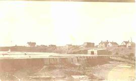
Part of MJ General Photograph Collection
Dam and boathouse on Moose Jaw River near Manitoba Street East
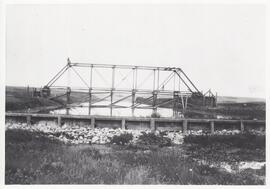
Dam and bridge under construction near Drinkwater, Saskatchewan.
Part of MJ General Photograph Collection
Dam and bridge under construction on the Moose Jaw River near Drinkwater, Saskatchewan.
The fonds contains 16 black and white photographs that originally belonged to Perley Fennell's personal collection. They date from between May of 1928 to April of 1934. One photograph features Donald McLaughlin standing near a house. The remaining photographs feature the Melfort dam and reservoir in various stages of thaw and flooding.
Fennell, Anna
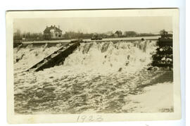
Dam overflow, Wolseley, Spring 1923
Part of WHFA Photos Collection
This photograph shows the original Canadian Pacific Railway (CPR) dam [built in 1902] that created Fairley Lake.
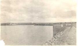
Part of City of Regina fonds
Boggy Creek dam site with dam full.
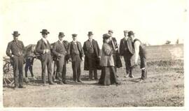
Mrs. Laird at turf-cutting ceremony
Part of City of Regina fonds
Mrs. H.W. Laird, wife of Mayor H.W. Laird, at turf-cutting ceremony at Boggy Creek. Men are all unidentified.
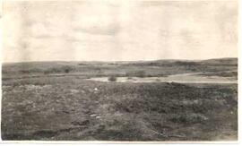
Boggy Creek before dam was there
Part of City of Regina fonds
The location of Boggy Creek dam before construction began.
Part of City of Regina fonds
Albert Street Bridge before the Albert Memorial Bridge was constructed.

Boggy Creek Dam under construction
Part of City of Regina fonds
Boggy Creek Dam construction site, with unidentified women posing in front of construction.
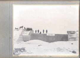
Part of City of Regina fonds
Boggy Creek Dam in its recently completed state with men and a horse on top of it.
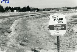
The Trapp Family Wetland Conservation Project
The Trapp Family Dams, a wetland wildlife conservation project built by Ducks Unlimited, 1991-1993.
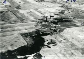
An aerial view of the Trapp Family Dam. A Ducks Unlimited conservation project.
Part of LRA Photograph Collection
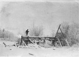
C.A.J. Bowen standing on dam at Frog Lake
Part of W.O. Kupsch fonds
Map of the Netherlands without dikes. Shows the potential area of flooding by sea water and fresh water. Map copied from a book.
Water flowing through damaged dikes
Part of W.O. Kupsch fonds
Aerial photograph of water streaming with great force through two gaps in the dikes.