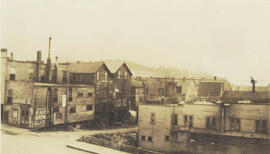
- INS-497
- Pièce
- [ca. 1927]
Fait partie de Institute for Northern Studies fonds
A closeup of a street in Prince Rupert, BC.

Fait partie de Institute for Northern Studies fonds
A closeup of a street in Prince Rupert, BC.

"View of Prince Rupert Water Front"
Fait partie de Institute for Northern Studies fonds
An aerial view of Prince Rupert, BC.

Aerial photo of Uranium City, Saskatchewan
Fait partie de R.M. Bone fonds
Aerial view of Uranium City, Saskatchewan.
Sans titre
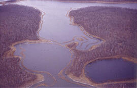
Aerial view of dead ice moraine - effects of lowered water level
Fait partie de W.O. Kupsch fonds
Aerial view of dead ice moraine showing the effects of lowered water level in ponds; Western part of Moose Mountain, Saskatchewan.
Sans titre
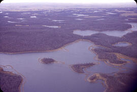
Aerial view of dead ice moraine - effects of lowered water level
Fait partie de W.O. Kupsch fonds
Aerial view of dead ice moraine showing the effects of lowered water level in ponds; Western part of Moose Mountain, Saskatchewan
Sans titre
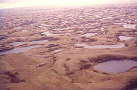
Aerial view of dead ice moraine with knob and kettle topography
Fait partie de W.O. Kupsch fonds
Aerial view of dead ice moraine with knob and kettle topography; Western part of Moose Mountain, Saskatchewan.
Sans titre

Fait partie de University of Saskatchewan Photograph Collection
View from the south of Chemistry (Thorvaldson) Building, Administration Building, Saskatchewan Hall, Qu'Appelle Hall and the Bowl.
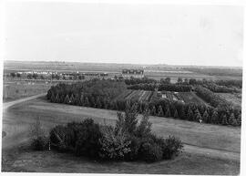
Agricultural Research - Experimental Plots
Fait partie de University of Saskatchewan Photograph Collection
Elevated view of fields with plants and bushes in foreground; Seed Barn in the distance.
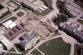
Physics Building - Construction
Fait partie de University of Saskatchewan Photograph Collection
Aerial view showing construction of the Physics addition, with a partial view of the Bowl and Administration Building.
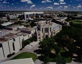
Fait partie de University of Saskatchewan Photograph Collection
Looking northeast from top of Arts Tower with Thorvaldson Building in foreground. Newly-completed Agriculture Building in background.
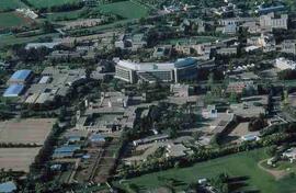
Fait partie de Educational Media Access and Production (EMAP) fonds
Aerial of west/central campus, Agriculture Building in centre.
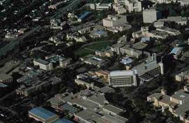
Fait partie de Educational Media Access and Production (EMAP) fonds
Aerial of west/central campus, includes the Agriculture Building and the Bowl.
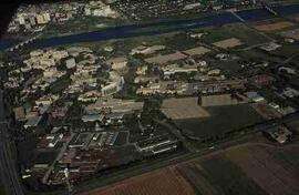
Fait partie de Educational Media Access and Production (EMAP) fonds
Aerial of campus from southwest with surrounding city, river and bridges.
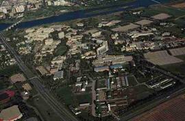
Fait partie de Educational Media Access and Production (EMAP) fonds
Aerial of Campus from southeast, includes surrounding city, Field House, river and bridges.
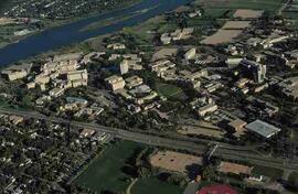
Fait partie de Educational Media Access and Production (EMAP) fonds
Aerial of Campus with surrounding city and river.