- MG 108 2-B-10-18
- Pièce
- 1929
Fait partie de H.A. Lewis fonds
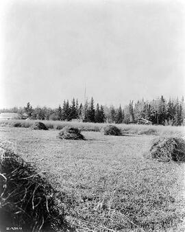
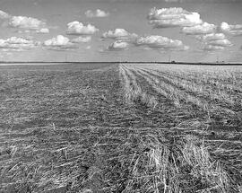
A field is seen with stacks of straw on it; two cabins and a barn are seen in the background.
Sans titre

Fait partie de H.A. Lewis fonds
A field is seen with stacks of straw on it; two cabins and a barn are seen in the background.
Sans titre
Fait partie de H.A. Lewis fonds
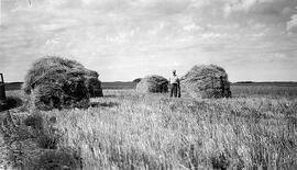
A man is seen in a field standing next to a "barge" stack of straw. Several more stacks are seen around him.
Sans titre
Fait partie de H.A. Lewis fonds
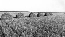
A field is seen with "barge" stacks of straw on it. Several more stacks are seen in the distance.
Sans titre
Fait partie de H.A. Lewis fonds
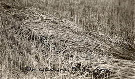
A row of wheat is seen laying on the ground from snow.
Sans titre
Fait partie de H.A. Lewis fonds
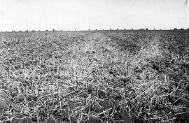
A field is seen laying fallow in the summer at the Regina Experimental Station. One half was cultivated with a Duckfoot Cultivator and the other with a One-way discer.
Sans titre
Fait partie de H.A. Lewis fonds
A field is seen laying fallow after it was cultivated with a V-shaped Noble Blade.
Sans titre
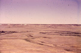
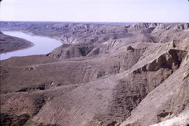
Meandering River in Frenchman Valley near Watson's Bridge
Fait partie de W.O. Kupsch fonds
Meandering River in Frenchman Valley near Watson's Bridge looking south; one can also see the prominent white band: Whitebud formation (Upper Cretaceous)
Sans titre
Clay facies of the Frenchman River over sand facies
Fait partie de W.O. Kupsch fonds
Clay facies of the Frenchman River over sand facies exposed at guly; Frenchman River near Busse Ranch, Eastend area of Saskatchewan.
Sans titre
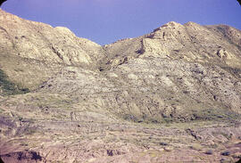
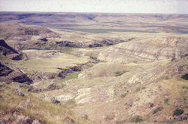
Ravenscrag Butte, Saskatchewan
Fait partie de W.O. Kupsch fonds
Grey (below) and buff facies at Ravenscrag (Paleocene) formation at type section, Ravenscrag Butte, Saskatchewan.
Sans titre
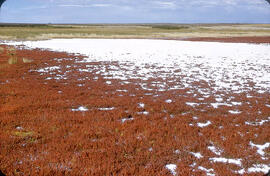
"Alkali" salt flat near Cantuar, Saskatchewan
Fait partie de W.O. Kupsch fonds
"Alkali" salt flat at shore of a saline lake near Cantuar, Saskatchewan; note abundance of salt wort (Salicornia rubra).
Sans titre
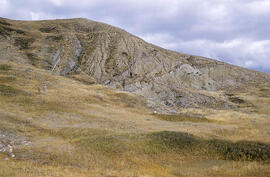
Ice thrust till folding into bedrock
Fait partie de W.O. Kupsch fonds
General view of till folding into bedrock. In SE corner Sec. 28, T. 10, R. 26, W. 2. Sunday, October 2, 1960.
Fait partie de W.O. Kupsch fonds
Blackstrap Coulee near Dundurn, Saskatchewan. June 1967.
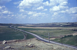
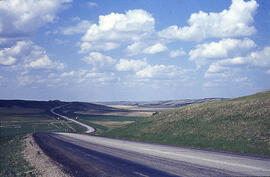
Highway 11 at Blackstrap Coulee
Fait partie de W.O. Kupsch fonds
Highway 11 crossing Blackstrap Coulee near Dundurn, Saskatchewan. Note lag concentrate of large boulders in foregroundon eroded valley slope; dam in background, reservoir not yet filled. June 1967.
South Saskatchewan River near Prelate Ferry
Fait partie de W.O. Kupsch fonds
South Saskatchewan River and Pleistocene section near Prelate Ferry, Saskatchewan.
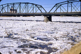
Fait partie de W.O. Kupsch fonds
Ice jamming during break up. Notice the branches, etc. on ice.