- F. Slides, 7. Emma Lake - 1979-1991
- Item
- August, 1984
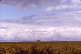
Parte de Hans Dommasch fonds
The flat horizon is seen over a field of yellow plants near Emma Lake, Saskatchewan.
Sem título

5 resultados com objetos digitais Mostrar resultados com objetos digitais
Parte de Hans Dommasch fonds
The flat horizon is seen over a field of yellow plants near Emma Lake, Saskatchewan.
Sem título
Dune erosion from gales , North of Bergen aan Zee
Parte de W.O. Kupsch fonds
Aerial photograph showing the gaps in dunes caused by violent gales, North of Bergen aan Zee.
Map of the Netherlands during Roman times
Parte de W.O. Kupsch fonds
Map of the Netherlands during Roman times showing land area and river channels.
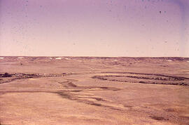
Meandering River in Frenchman Valley near Watson's Bridge
Parte de W.O. Kupsch fonds
Meandering River in Frenchman Valley near Watson's Bridge looking south; one can also see the prominent white band: Whitebud formation (Upper Cretaceous)
Sem título
Map of the Netherlands, 16th century
Parte de W.O. Kupsch fonds
Map of the Netherlands during the 16th century. Shows the land area and drainage channels.
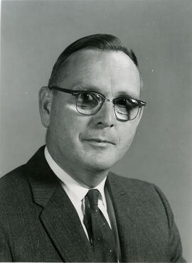
Head and shoulders image of J. Howard Richards, Professor and Head, Department of Geography.
Bio/Historical Note: J. Howard Richards was born 21 May 1916 in Caerphilly, Wales. He enrolled at the University of Wales in 1934 and graduated in 1938 with a B.Sc. in Geography. Richards remained in Wales the following year to teach at a private school and spent the next two years as a Meteorologist in the United Kingdom and Canada. He joined the Royal Canadian Army, serving in Europe from 1942-1946. After his discharge, Richards enrolled at the University of Toronto; in 1947 he received his MA. Richards taught at Utica College of Syracuse University and the University of Manitoba before returning to the University of Toronto, where he earned his PhD in 1956. He briefly joined the staff of the Royal Military College of Canada prior to coming to the University of Saskatchewan in 1960 as Professor and Head of the newly formed Department of Geography. He was to remain in that post until his retirement in 1979. He was named Professor Emeritus in 1983. During his tenure, Richards developed academic programs in Geography and the interdisciplinary programs of Land Use, Environmental Studies and Regional and Urban Development and Planning. He was the editor of the first "Atlas of Saskatchewan" and the author of "Saskatchewan Geography" and "Saskatchewan: A Geographical Appraisal," among other publications.
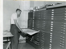
J.C. McConnell, instructor in Geography and Librarian for the Land Use Mapping Project, checks the accuracy of maps made from air photo interpretations.

Aerial photo of Uranium City, Saskatchewan
Parte de R.M. Bone fonds
Aerial view of Uranium City, Saskatchewan.
Sem título
Population density shown on world map
Parte de W.O. Kupsch fonds
Population density shown on world map.
Coastal dunes. Noordwijk, The Netherlands
Parte de W.O. Kupsch fonds
Coastal dunes. Noordwijk, The Netherlands.
Coastal dunes. Noordwijk, The Netherlands
Parte de W.O. Kupsch fonds
Coastal dunes. Noordwijk, The Netherlands. Showing blow out.
Scaling of weathered tombstone of mica schist
Parte de W.O. Kupsch fonds
Scaling of weathered tombstone of mica schist. Cemetery of Trinity Church, Broadway, Manhattan, N.Y.
Tombstone of mica schist bending under own weight
Parte de W.O. Kupsch fonds
Tombstone of mica schist bending under own weight. Cemetery of Trinity Church, Broadway, Manhattan, N.Y.
Tombstone of mica schist bending under own weight
Parte de W.O. Kupsch fonds
Tombstone of mica schist bending under own weight. Cemetery of Trinity Church, Broadway, Manhattan, N.Y.
Tombstone mica schist bending under own weight
Parte de W.O. Kupsch fonds
Tombstone mica schist bending under own weight. Cemetery of Trinity Church, Broadway, Manhattan, N.Y.