- LRA 0301
- Pièce
- August, 2005
Fait partie de LRA Photograph Collection
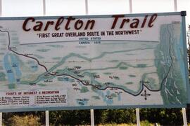
Sign depicting a map of the Carlton Trail from Upper Fort Garry, Manitoba to Fort Edmonton, Northwest Territories.
6 résultats avec objets numériques Afficher les résultats avec des objets numériques
Fait partie de LRA Photograph Collection
Sign depicting a map of the Carlton Trail from Upper Fort Garry, Manitoba to Fort Edmonton, Northwest Territories.
Fait partie de Howard Jackson Collection
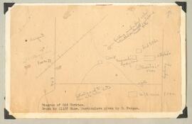
Hand drawn image of Old Yorkton
Fait partie de University of Saskatchewan Photograph Collection
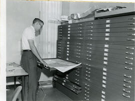
J.C. McConnell, instructor in Geography and Librarian for the Land Use Mapping Project, checks the accuracy of maps made from air photo interpretations.
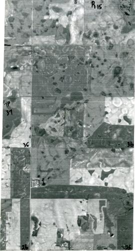
Aerial View of The Rural Municipality of Biggar #347
Fait partie de Biggar Photograph Collection
An aerial view of TP 37 RG 15 in the Rural Municipality of Biggar # 347
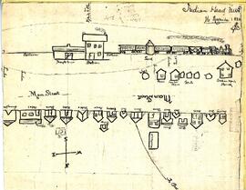
Hand-drawn map/sketch of Indian Head in 1882
Fait partie de Town Collection
Sketch/map by Edwin J. Brooks of the CPR station and buildings along the railway - all labelled. A path (later Grand Avenue) goes to the northwest and is labelled "To Bell..."
Sans titre
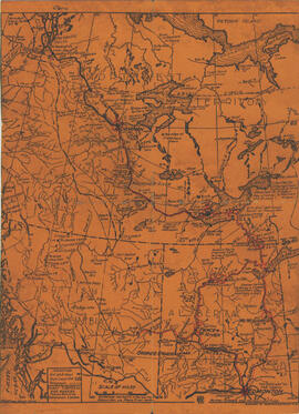
Alberta & Artic Transportation Company Limited Map
Fait partie de Institute for Northern Studies fonds
A printed map of Alberta, British Columbia and the Northwest Territorries, with the Mackenzie and Peace Rivers outlined. (Not a photograph)
Fait partie de W.O. Kupsch fonds
Map of the Netherlands without dikes. Shows the potential area of flooding by sea water and fresh water. Map copied from a book.
Map of the Netherlands, 16th century
Fait partie de W.O. Kupsch fonds
Map of the Netherlands during the 16th century. Shows the land area and drainage channels.
Fait partie de W.O. Kupsch fonds
Citation reads: "Billboard map of settlement, Tuktoyaktuk, N.W.T. August 21, 1965."