Aerial view of northern Baffin Island
- WOK 20-4
- Item
- 1965
Part of W.O. Kupsch fonds
Citation reads: "Aerial view of nice cap in distance, fiords in foreground, northern Baffin Island, August 16, 1965."
56 results with digital objects Show results with digital objects
Aerial view of northern Baffin Island
Part of W.O. Kupsch fonds
Citation reads: "Aerial view of nice cap in distance, fiords in foreground, northern Baffin Island, August 16, 1965."
Excavated watertank in front of temple at Mohenjo Daro, Indus Valley
Part of W.O. Kupsch fonds
Photograph of a watertank in front of excavated temple at Mohenjo Daro. Oldest known use of bitumen as a damp cource, 3,000 BC. Photograph copied from a book.
Part of L.G. Saunders fonds
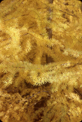
A close-up view of the foliage of a Golden Tamarack.
Saunders, Leslie Gale
The images in this fonds primarily document volcanology, and were taken during various international field trips.
Coleman, Leslie C.
Map of oil fields in Pakistan-India-Burma, after Landes
Part of W.O. Kupsch fonds
Map of oil fields in Pakistan-India-Burma. Map copied from a book.
University of Saskatchewan flower bed
Part of L.G. Saunders fonds
A University of Saskatchewan flower bed is seen at the north end of the Quad with the Chemistry building seen in the distance on a clear spring day.
College Of Arts and Science Dean's Office fonds
This fonds contains material relating to the research work, students, faculty and administration of the College of Arts and Sciences, and its departments. These records generally contain correspondence, minutes, reports, and memoranda; they may also contain material relating to associated national or international organizations, research articles, and addresses.
University of Saskatchewan. College of Arts and Science. Dean's Office
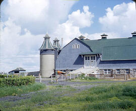
Barn with silos of the University of Saskatchewan
Part of L.G. Saunders fonds
The Main barn and it's silos of the University of Saskatchewan are seen from the east side.
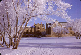
University of Saskatchewan M.U.B. and Qu'Appelle Hall
Part of L.G. Saunders fonds
The University of Saskatchewan M.U.B. and Qu'Appelle Hall are seen across a field in hoar frosty weather.
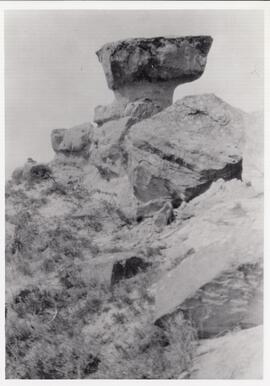
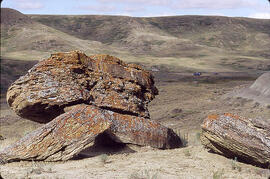
The rock formation that gave Rockglen, Saskatchewan its name.
Part of MJ General Photograph Collection
Photograph of the local rock formation which gave the town of Rockglen, Saskatchewan its name. It was later removed as it was considered dangerous.
Rock formation in the Cypress Hills area
Part of Hans Dommasch fonds
Several rocks are seen on a valley's edge near the Cypress Hills in Saskatchewan.
Dommasch, Hans S.
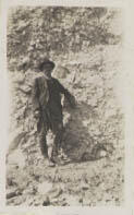
A man with a [hatchet] posing in front of a cliff face.
Tidal flats at Apex coverd by water during high tide
Part of W.O. Kupsch fonds
Citation reads: "Tidal flats at Apex coverd by water during high tide, Frobisher Bay, N.W.T. August 8, 1965."
"Exposed tidal flats from Apex Community"
Part of W.O. Kupsch fonds
Citation reads: "Exposed tidal flats from Apex Community, Frobisher Bay, N.W.T. August 8, 1965."
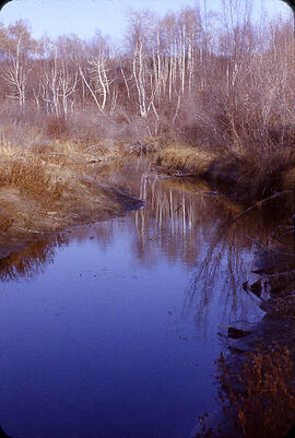
Part of L.G. Saunders fonds
Beaver Creek's calm waters are seen as they wind though a autumn trees and grasses.
Saunders, Leslie Gale