- 991-047-005
- Pièce
- [between 1920 and 1939]
Fait partie de Flett, Dagmar fonds
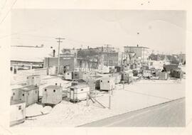
Sledges and cabooses stopped at Fletts Livery barn on Saskatchewan Ave., Melfort.
Fait partie de Flett, Dagmar fonds
Sledges and cabooses stopped at Fletts Livery barn on Saskatchewan Ave., Melfort.
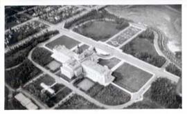
Saskatchewan Legislative Grounds and Wascana Lake
Fait partie de City of Regina fonds
Aerial view of the Saskatchewan Legislative Grounds and Wascana Lake; note that Wascana Lake is drained/empty.
Sans titre
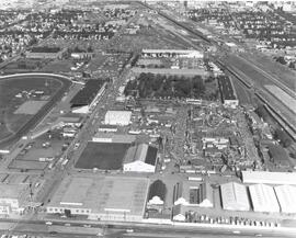
Exhibition Grounds with midway
Fait partie de City of Regina fonds
Aerial view of Exhibition Grounds looking east from Regina Avenue. Midway and buildings in foreground, racetrack to the left.
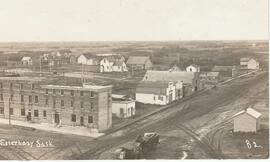
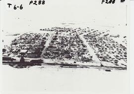
Central Hotel of Esterhazy Sask.
Fait partie de ECM Photograph Collection
An aerial vew of Esterhazy, Saskatchewan with the focal point being The Central Hotel, located at Main St. & Railway Ave. (facing West). This view includes (top left, clockwise): Clements home, Geo. Millham home, church parsonage, Millham granary, Gonczy home, Sellner’s cottage, Cosgrove home built by Dr. Kee, J.Sellner shop, Wilson livery, Mah Jim, C.P.R. pump-house, Shiminoski’s, Krupa’s (burned 1921), Central Hotel’s “Gas house”

Aerial View of the Melfort Research Farm
Fait partie de Melfort General Photo collection
An aerial view of the Melfort Research Farm in the winter time.
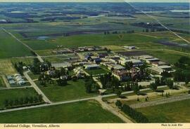
Lakeland College, Vermilion, Alberta
Fait partie de LRA Photograph Collection
Aerial view of Lakeland College campus in Vermilion, Alberta.
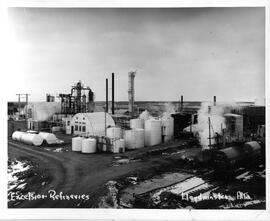
Excelsior Refineries, Lloydminster, Alberta
Fait partie de Barr Colony Heritage Cultural Centre Collection
Aerial/birds’ eye view of the Excelsior Refinery yard in Lloydminster, Alberta.
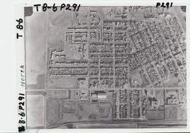
Aerial view of northwest quadrant of Lloydminster
Fait partie de LRA Photograph Collection
View of Northwest portion of Lloydminster with the old Catholic Church in foreground
Fait partie de Melfort General Photo collection
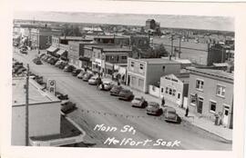
Aerial view of the 200 Block (west side) of Main Street in Melfort, Saskatchewan.
Sans titre
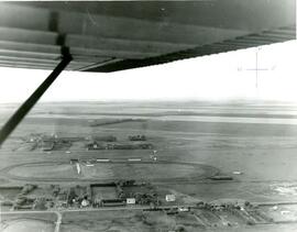
Aerial photo of Indian Head horse race track and former airport
Fait partie de Town Collection
Photograph taken from an airplane looking north over the fairgrounds/horse race track to the former airport - now Indian Head Golf Course.
Fait partie de Frank Glass Photograph Collection
An aerial photo of Rosetown taken directly overhead with the southwest corner of town out of view.
Fait partie de Frank Glass Photograph Collection
An aerial photo of Rosetown taken in winter taken from the south looking north.
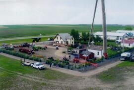
Aerial view of Museum and grounds
Fait partie de Rosetown General Photograph Collection
Aerial view shows the Tea House, Fire Hall, School, Church, Blacksmith Shop, tractors, and main buildings. Photographed from a SaskTel balloon in 2008.
Fait partie de Rosetown General Photograph Collection
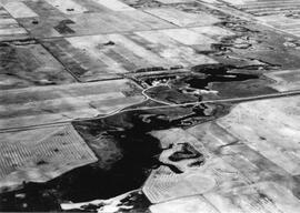
An aerial view of the Blind Creek near Zealandia flooding in the spring. The water flowed west to east and met up with the South Saskatchewan River near Saskatoon.