- 999-099-010.09
- Item
- [1940s-1950s]
Part of Melfort General Photo collection
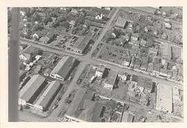
Aerial view of the 200 Block (west side) of Main Street in Melfort, Saskatchewan.
Carson of Skyline
750 results directly related Exclude narrower terms
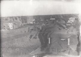
Part of Melfort General Photo collection
Aerial view of the 200 Block (west side) of Main Street in Melfort, Saskatchewan.
Carson of Skyline
Aerial view of Melfort, Saskatchewan
Part of Melfort General Photo collection
Aerial view of Melfort Saskatchewan
Carson of Skyline
Part of LRA Photograph Collection
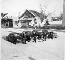
Ross Carruthers, Ralph Stevenson, Gordon Carruthers and Bob Moore are seen standing in a street from above in front of four cars parked under flags stringed across the street. Each are wearing a curling sweater.
Aerial view of settlement, Inuvik, N.W.T.
Part of W.O. Kupsch fonds
Citation reads: "Aerial view of settlement, Inuvik, N.W.T. August 22, 1965."
A closeup of a street in Prince Rupert, BC.

"View of Prince Rupert Water Front"
An aerial view of Prince Rupert, BC.
Part of MJ General Photograph Collection
Aerial view of Tuxford, Saskatchewan ‘in the early years’.

Aerial photo of Uranium City, Saskatchewan
Part of R.M. Bone fonds
Aerial view of Uranium City, Saskatchewan.
Hunting Survey Corporation Limited Toronto, Canada
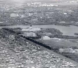
Aerial view of Regina looking northeast
Part of City of Regina fonds
Aerial view looking northeast over the city. The Legislative Buildings, Wascana Lake and Campion College are seen in foreground. From Thornton Avenue to outer city limits (north), Rae Street to east edge of Wascana Park.
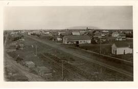
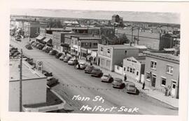
Railway tracks - Melfort, Saskatchewan
Part of Melfort General Photo collection
Aerial view of the railway tracks and grain elevators on Saskatchewan Avenue in Melfort, Saskatchewan.
Voldeng, D.H.
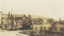
The fonds contians two black and white photographs from Dagmar Flett's personal collection. One photograph is of Melfort, Saskatchewan looking south over Saskatchewan Avenue, taken from an elevator in the 1920s. The second photograph depicts cabooses stopped at the Melfort livery stable, and was taken in the 1930s.
Flett, Dagmar
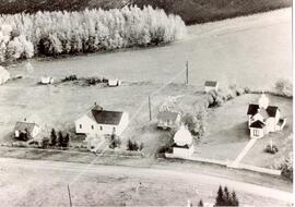
Part of Walcer, Mary fonds
Aerial view of the Maryville School, Teacherage and Church in Maryville, Saskatchewan
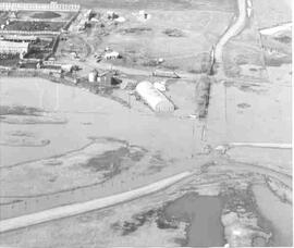
Part of MJ General Photograph Collection
Aerial view of roads and buildings flooded by Thunder Creek in Moose Jaw district
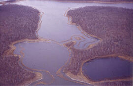
Aerial view of dead ice moraine - effects of lowered water level
Part of W.O. Kupsch fonds
Aerial view of dead ice moraine showing the effects of lowered water level in ponds; Western part of Moose Mountain, Saskatchewan.
Kupsch, Walter Oscar
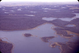
Aerial view of dead ice moraine - effects of lowered water level
Part of W.O. Kupsch fonds
Aerial view of dead ice moraine showing the effects of lowered water level in ponds; Western part of Moose Mountain, Saskatchewan
Kupsch, Walter Oscar